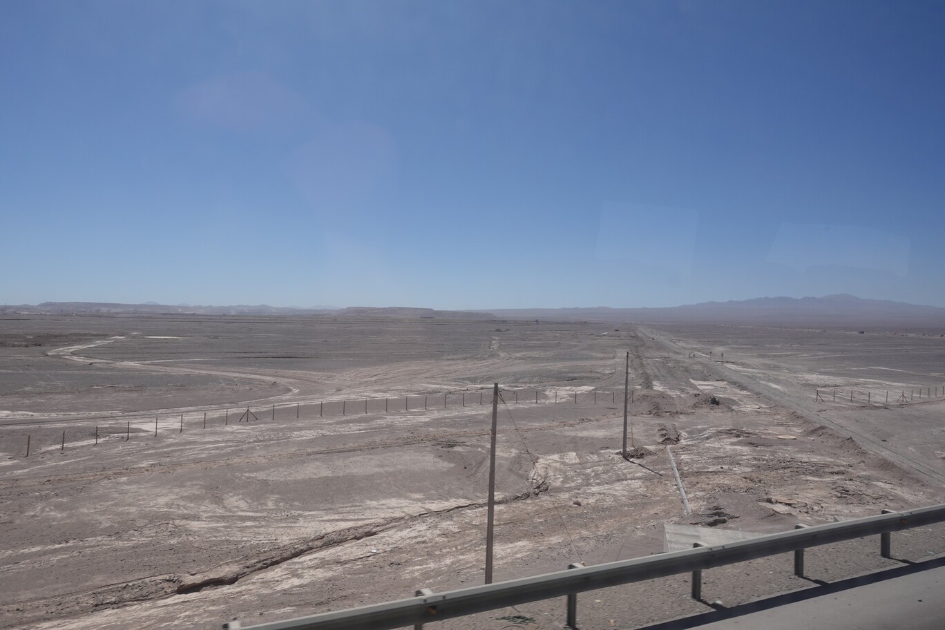
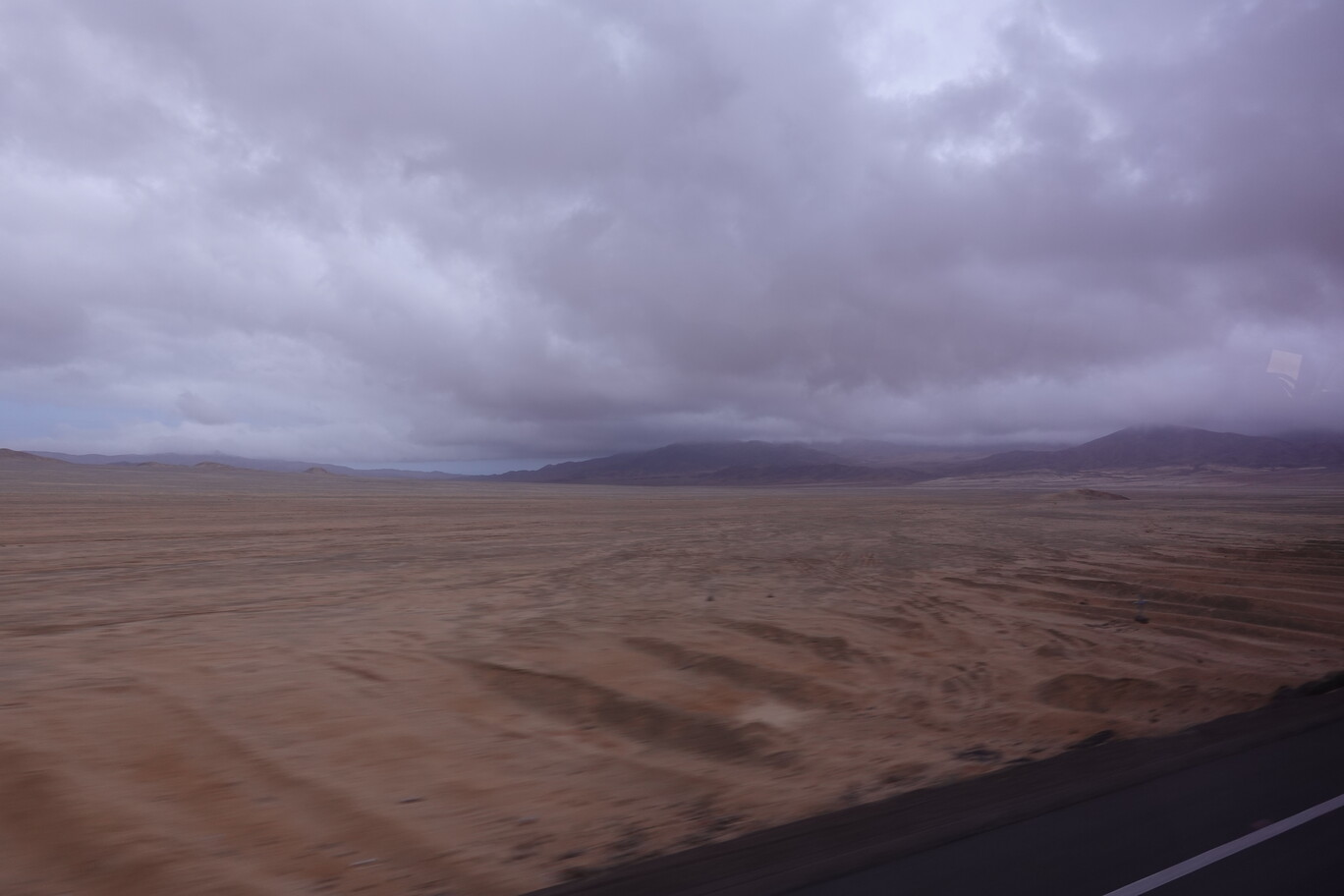
On Wednesday morning, 6th September, I went back to the bus terminal in Antofagasta. The bus to Calama wasn’t very full. It was more like a local bus connecting the two towns. We picked up some more passengers on our way out of town. For the first 10 km the road follows a steep valley out of town and climbing up to 500 m elevation. Afterwards we reached a high plateau which we followed for the next 200 km to Calama while climbing continuously to about 2,000 m. The incline is so gentle, that you wouldn’t realise it without having a pressure sensor. There’re countless copper mines in the Antofagasta region. Some even creating new hills and mountains from the rock deposits.
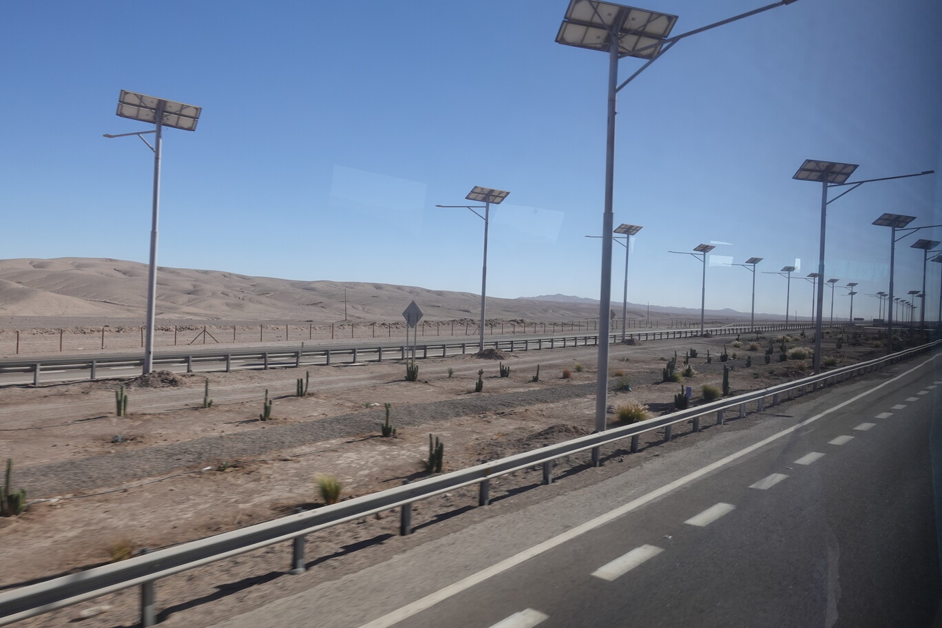
Typical for Chile: Bus, Bus we need more BusWhat are we going to do with all this Prosperity Rubbish? Dig a whole in the desert, and call it Waste “Treatment”Gained the Coastal Mountain range and reached the start of the high plateau, with one of several solar farms nearbyTipper Bodies from the Mines waiting for maintenance or re-useThe Morning Bus was already a bit run down, but would’ve been OK for a “short” trip
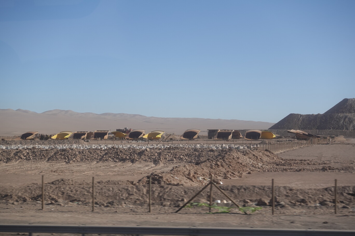
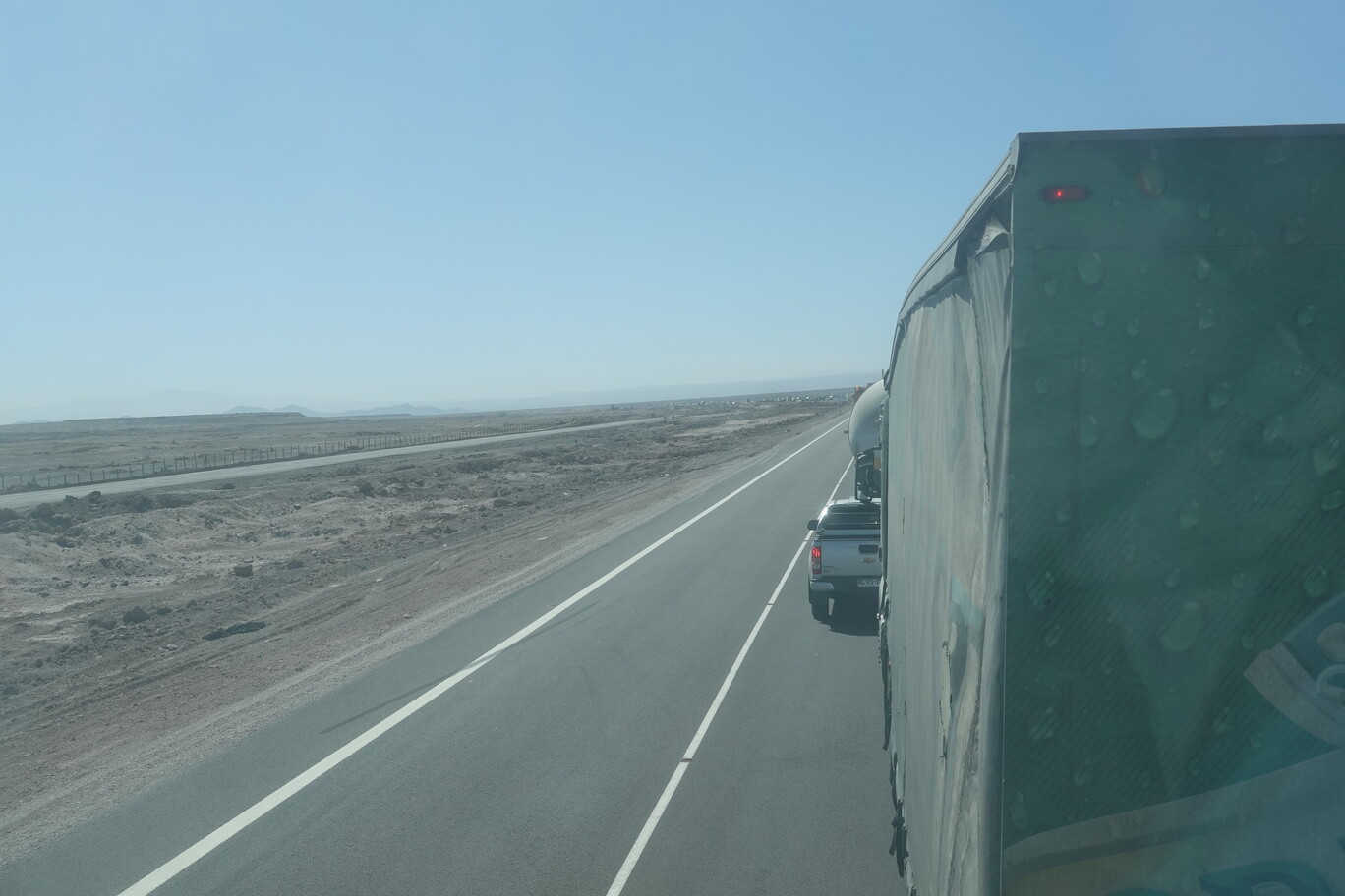
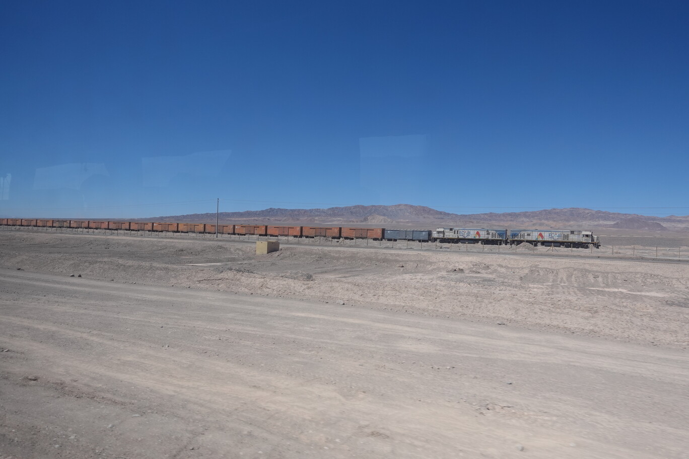
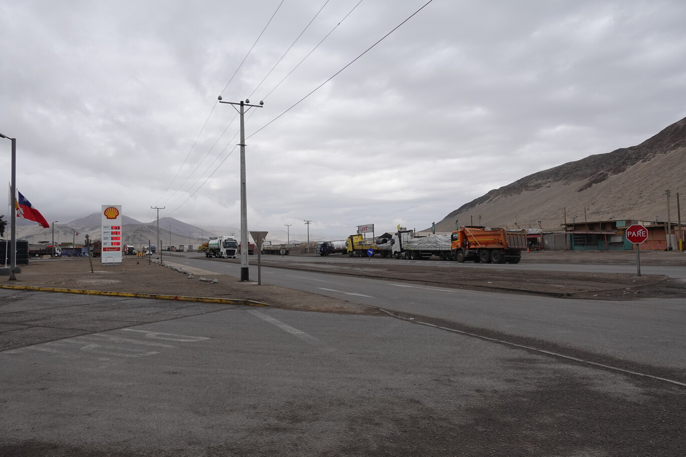
In Baquedano the FCAB railway to Bolivia and the Main Northern Railway Line to Iquique are crossing here. The road to Calama follows to FCAB. Behind Baquedano was a traffic accident. We were for about one hour in the traffic jam. Yes, in the middle of nowhere is a traffic accident, and hundreds of trucks are queued in line to pass, because there’s no other road. As it turned out later, two red pickup trucks had a nearly head-on collision. The blokes also think they’re invincible in their (almost) tanks. Speeding on a single lane highway, and then complaining when something goes wrong. Not sure, if it hurt enough, and if they would learn anything. And what does the government do? They upgrade the highway to four lanes all the way to Calama, so the blokes can more easily overtake (and speed). What a great “solution”.
Baquedano celebrates it’s existence due to the crossing of two railways Solar Lights at highway crossings…if you need a solar panel, just go there in the night and grab one, it’s the North of Chile. This must be new, as for most of the posts the panels are already “lost”…What use is all the good intention of using renewables, if some people just destroy easily this infrastructure?!Remnants of an old mining operation behind the FCABSeveral kilometres of traffic jam…in the middle of the desert (I was in several deserts, but never had that before)
So instead of 3 h, the bus trip took more like 4.5 h for 200 km. Would be happy to take the train instead along the FCAB, which is still operational. Since 1892 a 340 km long water pipeline drew water from the Río San Pedro, mainly to supply the steam engines of the FCAB, but eventually also supply Antofagasta with (limited amounts of) water. Hence, this pipeline runs parallel to the FCAB railway tracks. As we were late, I missed my connection bus to San Pedro de Atacama. The ticket office of that bus company was closed, but people reassured me, that the person comes back “soon”, as he was in Siesta. I asked three people independently, if the bus would leave from here at 15:30 o’clock, and they all rest assured me that’s the case. So, I waited at the terminal. At 15:25 the bloke came back. I wanted to buy a ticket for the bus in 5 min. He said, he could sell me a ticket, but the bus wouldn’t leave from here, nor would it stop here. Instead the bus would leave from another “terminal” about 1 km away in downtown. What a great user friendliness to have multiple bus terminals in a small town like Calama. It was impossible to get there in 5 min. So, I walked to that other terminal, bought a ticket, and waited again for the next bus at 18:00 o’clock.
Truck Traffic Congestion in Sierra Gorda. What are we going to do to alleviate that problem…Build more roads.Water Pipeline running parallel to the FCAB TracksWater Supply is a constant issue in this area, as the mine sites have an ever increasing demandCargo Train on the FCAB heading to Antofagasta
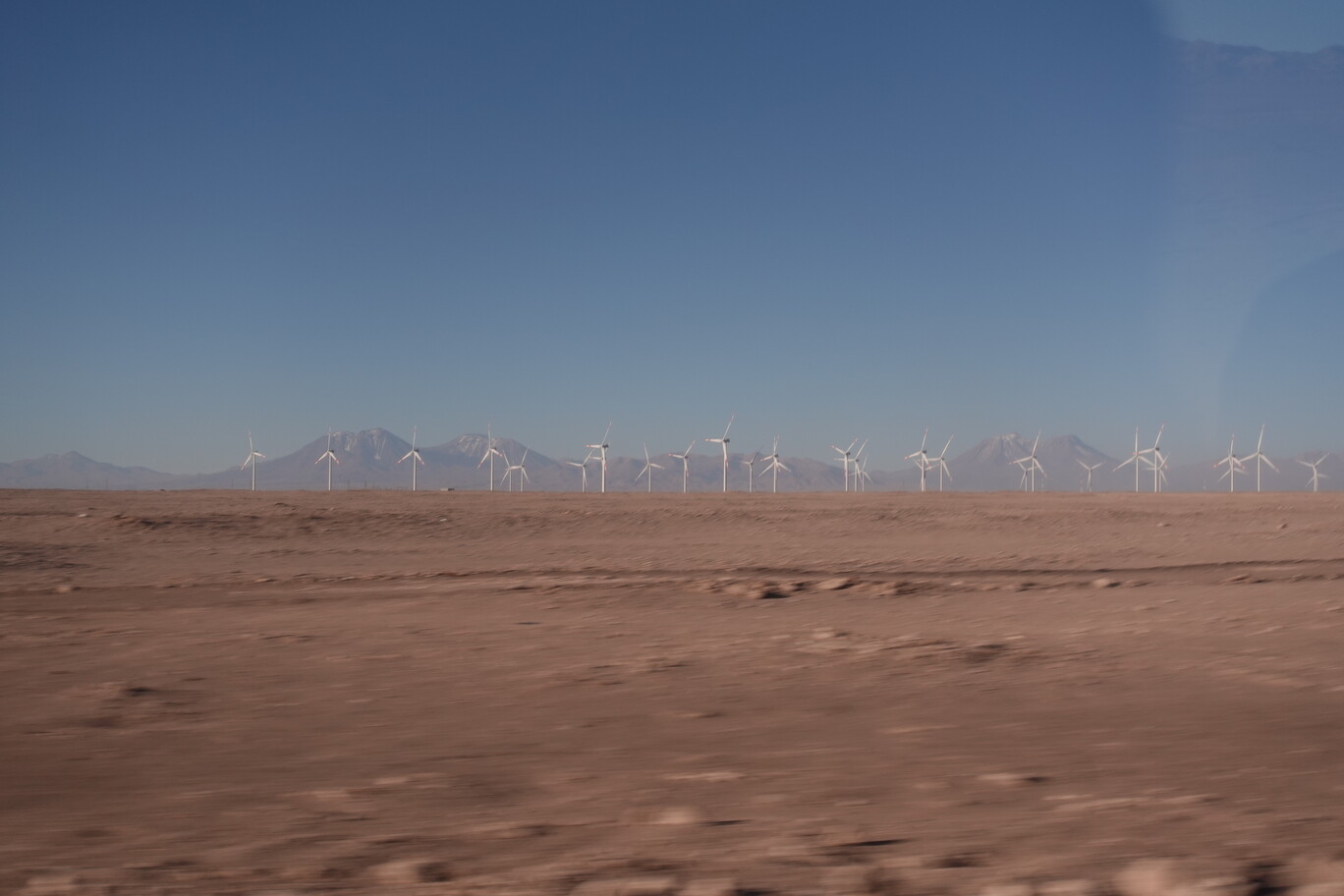
After more than 4 h waiting I finally left Calama. We passed the Jesus Statue on the way out of town, and then several big wind and solar farms. I was surprised to see so many wind farms at this altitude. Because in 2,000 m elevation the air density drops, but maybe this is compensated by the stronger and more continuously winds.
FCAB Railway Station in CalamaCristo del Desierto in CalamaPeople seem to think if they bring their rubbish out of town the problem is solved…no, it’s not.Huge Wind Farm……and Solar Farm (which I would’ve expected more here – even the strong winds could lead to potential stronger erosion of the panels itself due to all the sand) in front of the main Andean Range in the far background
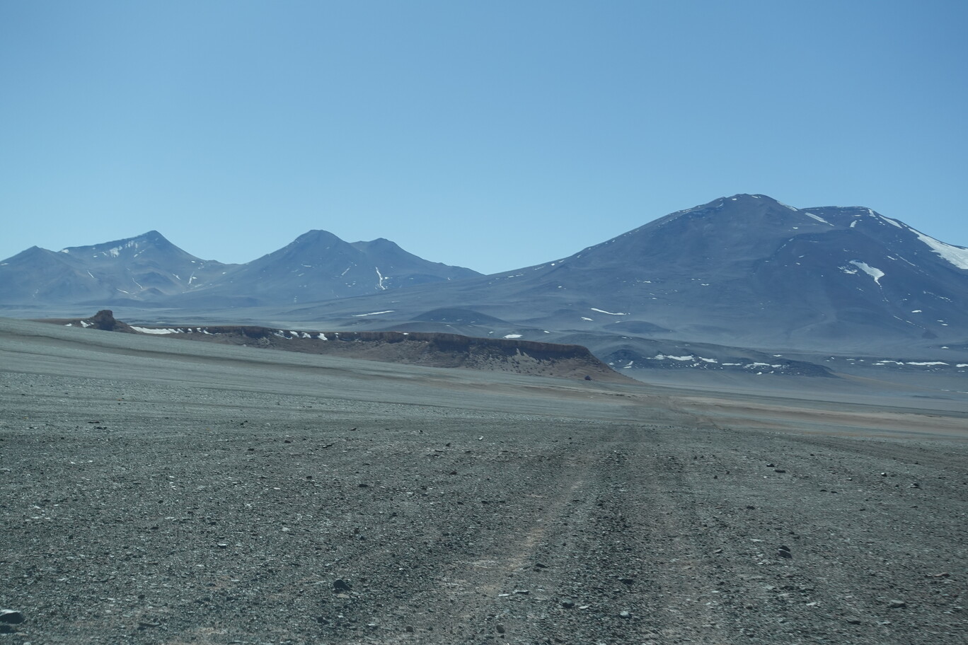
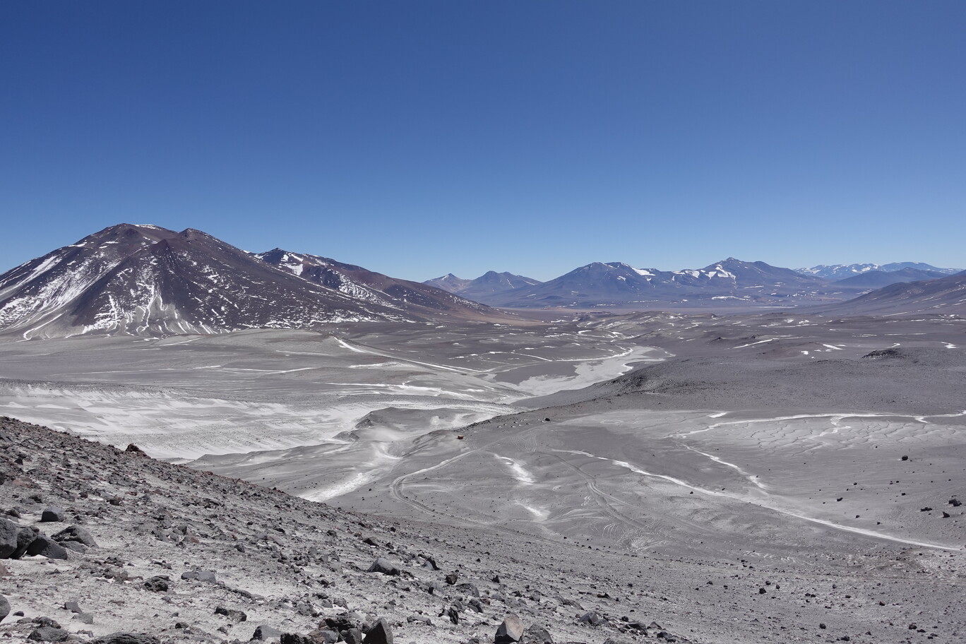
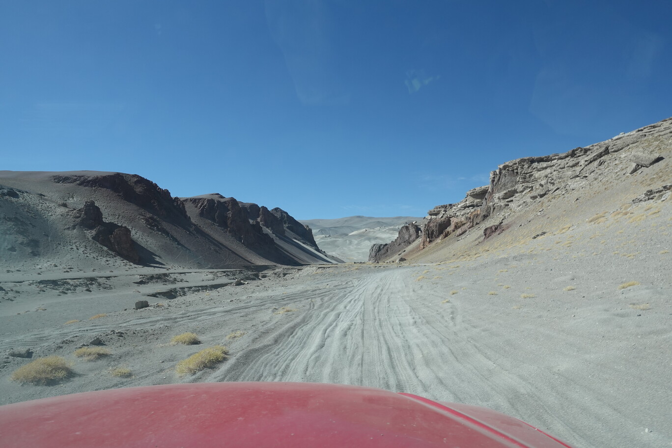
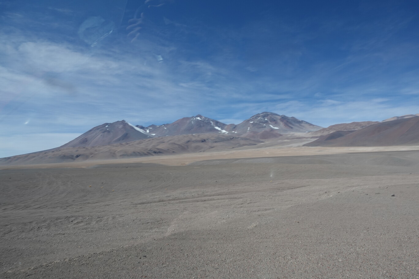
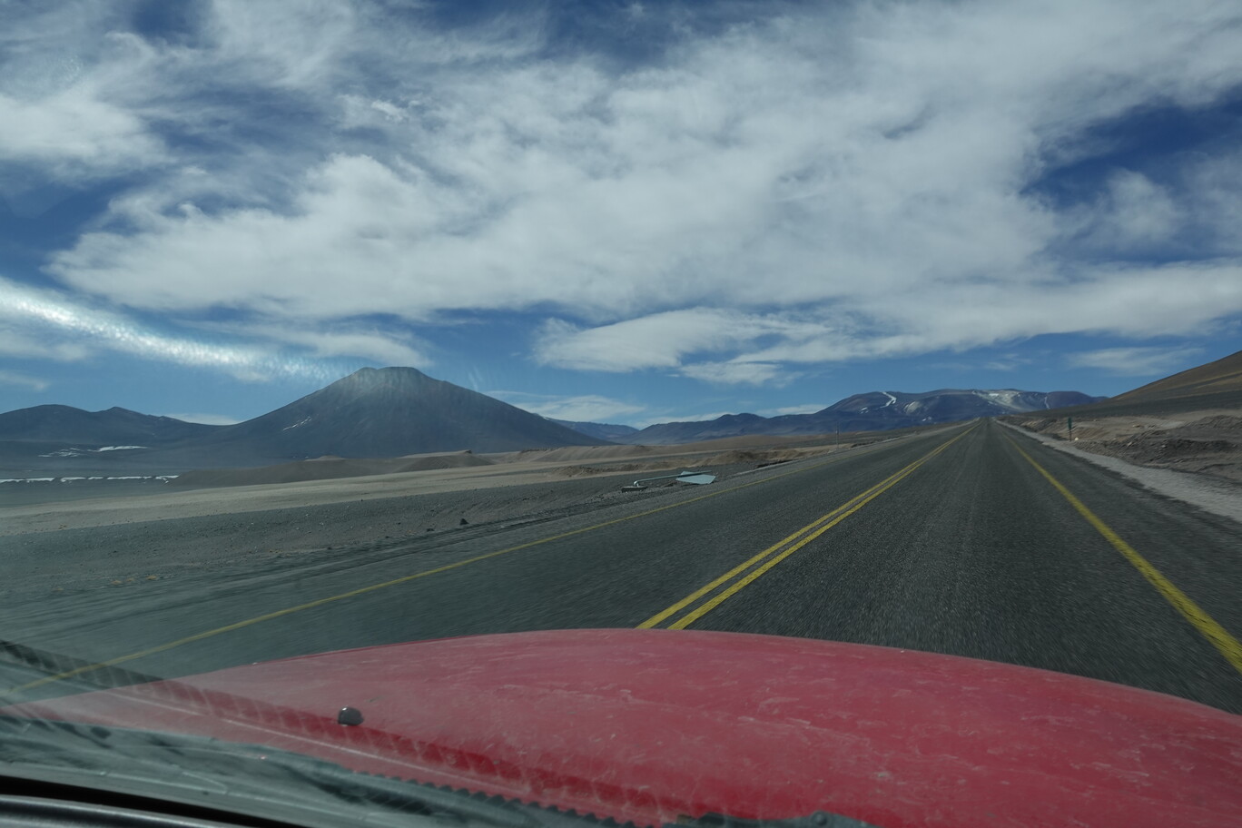
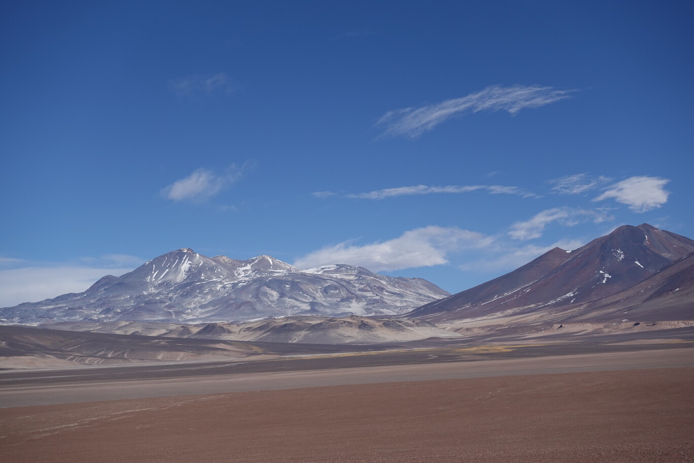
After we left the outskirts of Calama it was actually a nice drive through the Atacama desert. There wasn’t much traffic, nor many trucks because all the mines were behind us. After crossing the Barros Arena mountain pass across the Domeyko Mountain Range (yes, it’s still the same as on the way to the Maricunga Hut), we had a lovely sunset with a picturesque view to the main Andean mountain range on the other side of the Salar de Atacama flat.
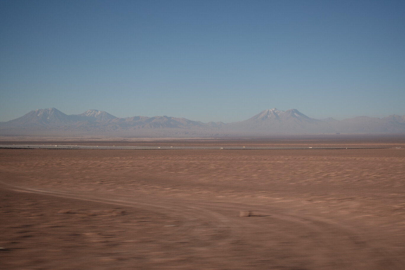
Natural Gas Transfer Station, the gas is imported from Argentina, and is for example used for electricity generation in San Pedro de Atacama…so don’t be fooled if you charge your electric vehicle thereEventually it was a nice bus ride……with a surprisingly marvellous sunset at the end of my bus stage today.
After a long day in the bus the day before, I walked through downtown of Antofagasta on Monday 4th September. Due to all the mining activities in the region is Antofagasta (one of) the richest city in Chile. Nevertheless, it’s also one of the most unsafe cities in Chile. You don’t want to be in certain parts of the city at night time. And even my hostel said, it’s just “OK” to walk one block to the next supermarket after dark. Thus, the wealthiness is hidden and kept secret behind barbed wire. I walked down the pedestrian street on the Arturo Prat street to the Plaza Colon Antofagasta. It was very vibrant during the morning, with lot’s of people around. The central market is just two blocks away, and around there, it’s even more busy. But the Plaza Sotomayor, directly in front of it, was strangely deserted. I don’t know what happened there before, maybe it was just temporal, but it seemed like all the people just run away.
Some Artwork in the bustling pedestrian street of Arturo Prat
Deserted Plaza Sotomayor in front of the Central MarketNice Plaza Colon in Antofagasta with their own version of the Big Ben in front of the Catedral
Further down, close to the port I crossed the port access railway tracks of the FCAB (Ferrocarril de Antofagasta a Bolivia). One of the few metre gauge railways in Chile which is still operational, though only for cargo. The old railway station of Antofagasta directly in the city centre is now a railway museum, but as it was Monday, I didn’t go in. There’re a few old waggons in the yard, and some other gear, but it didn’t look too big.
Railway Track to the Port between high-rise buildings in downtownOld FCAB railway station in downtown of Antofagasta
I continued along the shoreline and went to the pier in the small port of the fisheries terminal. There was an outdoor art exhibition ongoing. Yes, Antofagasta tries to become a bit more cultural, but it’s pretty hard with those mining blokes. One artwork impressed me the most. It put in a white flag for each Coup d’Etat happened in South America…there were more than 20 white flags, maybe even 40…thanks to the CIA.
Fishery PortWhite Flags for each Coup d’Etat that happened in South AmericaIt not only has to be a red one, no, but also a large one
Some Seals were looking for fish in the fishery port…free lunch for them
On Tuesday 6th September I went to the Playa Paraiso. This sandy beach is behind the fishery, and despite being directly in the city, it was actually quite clear. And as this would be my last day at the Pacific Ocean, and as it was actually quite warm in the sun, I opted to go to the beach. Yes, I know, I even can’t recall when I was the last time swimming in the Pacific, must have been Christmas Day 2021 at the Northern Beaches in Sydney. I’m known to be a beach boy, I used thoroughly my 50+ sunscreen…but I couldn’t reach quite all of my back. And despite that I wasn’t very long, and the fresh breeze didn’t feel it too warm either, the UV rays were merciless, and I got a heavily burnt back at that day.
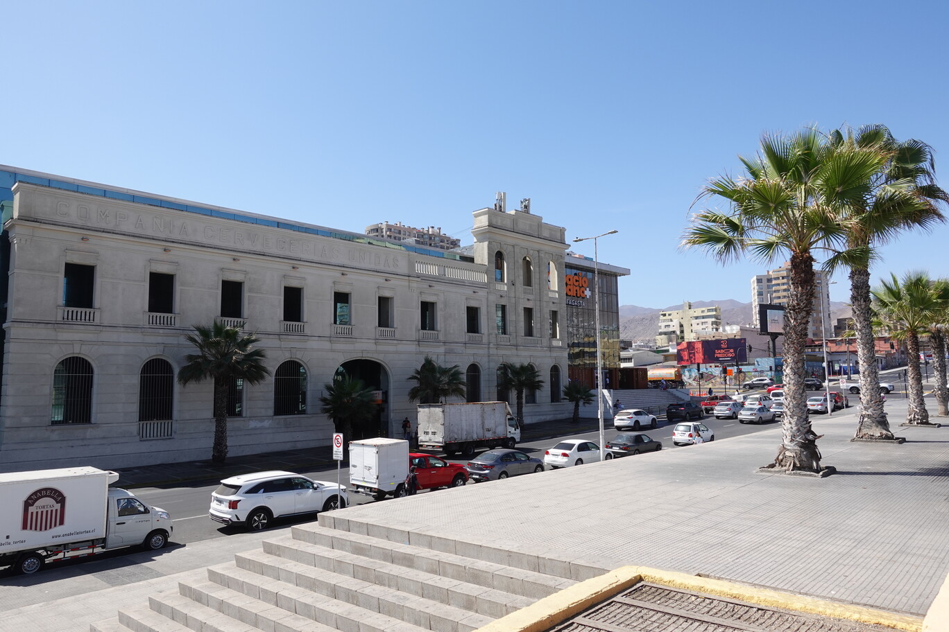
Playa Paraiso was quite nice in the middle of the cityOnly the original facade of the CCU (Compañía de Cervecerías Unidas) building still exists One Chilean Flag is not enough in front of the town hall…if you see anything green here, then it was due to irrigation. The mountain slopes in the back have the natural appearance
In the afternoon I walked by the former Railway Station in Antofagasta of the FCAB. As the original railway station was always congested with cargo traffic, a new one was built a bit outside downtown. After the privatisation of the railway networks (what a stupid idea that was), the passenger service finally ceased in 1980 in that railway station. There were plans to rebuilt it, but Plans Will Be Plans…nd the building is just deteriorating since more than 40 years.
The Sign of the Former……Railway Station of Antofagasta…
…and even the tracks nowadays make a big swerve around it.
After Mario and Elena dropped me off again in Copiapo the day before, I just walked across the road to the bus stop on Sunday morning 3rd September. It was the first time I took this company (just because it suited my schedule), and it was the worst experience. People had masses on luggage with them, as if they would relocate. I was even told there’s no space for my camping back and I would need to take it upstairs. Good on you to find space for this. Thus, I spread it over several free spaces in the overhead luggage rack. While I was waiting for the bus to depart, I could see two youngster couples smoking outside. First cigarettes, but then also sharing a pipe (it was presumably Paco, but I didn’t ask – it’s great of having a bunch of stoned drug addicts in the bus). Should you ever playing with the idea of taking up the profession of a drug dealer, just a small suggestion, try to dress inconspicuously. Wearing always red Nike shoes, a basecap the otherway around, and a fanny pack is semi-smart in that profession. Just a small tip from my side. So finally after several weeks around Copiapo, I was back on Route 5 – who would’ve thought that. On the way out of town the old rails from the Main Southern Railway Line followed us for a while. We continued to the coast, passing the airport, and reaching Calera after about 75 km. Here the 4 lane motorway upgrading ended, and from now on the Route 5 is a normal sealed highway.
Tracks of the Main Southern Railway Line in parallel just outside CopiapoReaching the ocean within under an hour……and passing Caldera.The bus was really packed, and every little space was used to store things
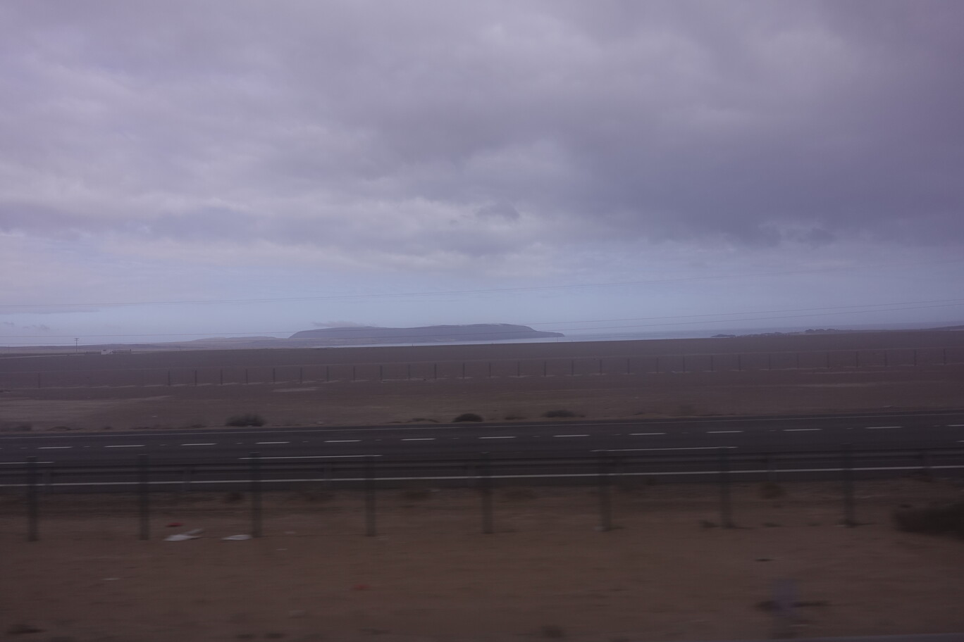
We followed the coastline for about 100 km. Yes, distances are vast here in the North, even if the road is sealed. Despite the random fishing hut, there wasn’t much along this part of the road, expect of a single port, to ship some kind of minerals. We had our lunch break in Chañaral. I just hopped onto the bus 2 h ago, so I wasn’t hungry. But for the people who already sat overnight since Santiago in the bus, it was a welcoming break I guess. I spoke briefly with one woman. She told me she’s originally from Venezuela, but lived in Chile for a while, and is going now from Chile to the US by bus. She expected it would take her about one month. This bus ends in Arica, directly at the border to Peru. So, it appears to be part of refugee stream. And that’s why the bus was fully loaded with stuff.
Small Single Berth Port on the CoastlinePacific Coastline was quite gently in this part of the roadPort of Chañaral still has some kind of railway connection, even if it seems to be disrupted to Diego de AlmagroIf you don’t have a working North-South Railway Line, then your supply line ends up on the road…with heaps of trucks
After Chañaral there’s not much, except a great desert landscape. I enjoyed driving through that part the most. We climbed up to about 2,000 m, before slowly descending on the other side of that mountain pass. I think we only stopped once to drop-off some passengers at the road junction to Taltal ( you really need to know what you’re doing here, but those looked definitely like locals). There’s no settlement in between, not even any huts or estancias are visible. Only several electricity lines run parallel to the Route 5.
Getting into the desert, just outside ChañaralTurnoff to Taltal at the coastThere was even a wind farm along the way to my surpriseAfter the clouds cleared a bit, the surrounding mountains pop outLooks like an autarkic communication relay station, powered by solar panels behind big wallsThe Clouds finally cleared and gave way to a stunning scenery
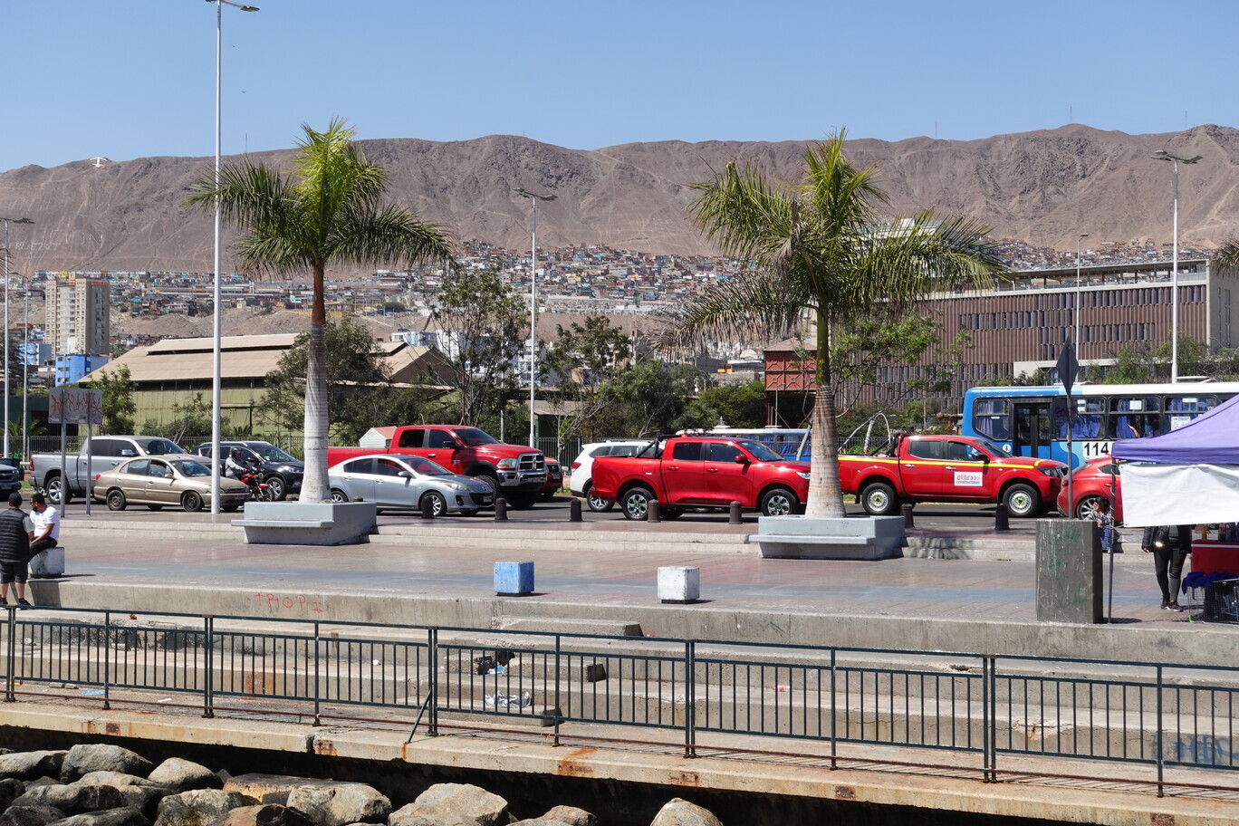
About 1 h before Antofagasta we passed the Hand of the Desert. We didn’t stop…well it’s a gigantic hand…in the desert…as the title would describe this artwork. Afterwards we reached the industrial complexes outside Antofagasta. Here everything is about mining. Glencore (yes, here we go again) operates a copper concentrate foundry (Fundicion Altonorte) – very clean business, and there’s a cement kiln directly next to the road. I’ve never seen a kiln so openly on display. For the next 25 km we followed a dry valley from about 500 m elevation down to sea level. The railway tracks now run again in parallel to the road. They looked like being in a very bad shape. In Antofagasta, when I tried to get my backpack off the bus, the girlfriend of one of the drug dealers also yelled for her luggage, behind me, while I tried to get my backpack on…well, it can’t work that way. Just wait a second, or go around me, until I got my luggage for god sake. So, I told her that in English. Her cool boyfriend with the red sneakers wasn’t happy about that. So, when I was walking off, he bumped deliberately into me. Well, I thought now it starts. I went into the bus terminal and observed him. But apart from rearing up and smoking a cigarette in the non-smoking area, he didn’t care anymore. I thought later, sure it was useless to say anything, this twat is resistant to advice, either because she’s too stupid, or simply drugged up…or both. But sometimes, I can’t resist to say what I think.
Hand of the Desert
Fundicion Altonorte – Glencore’s copper concentrate foundryOne of several mining supply companiesFinal Descent to Antofagasta on the coast with the railway tracks running (again) in parallel
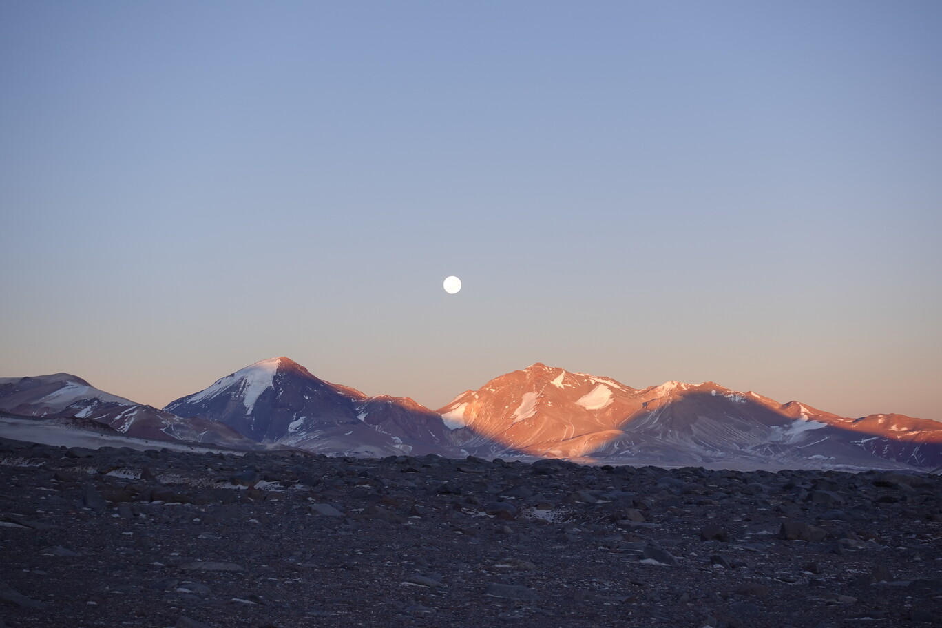
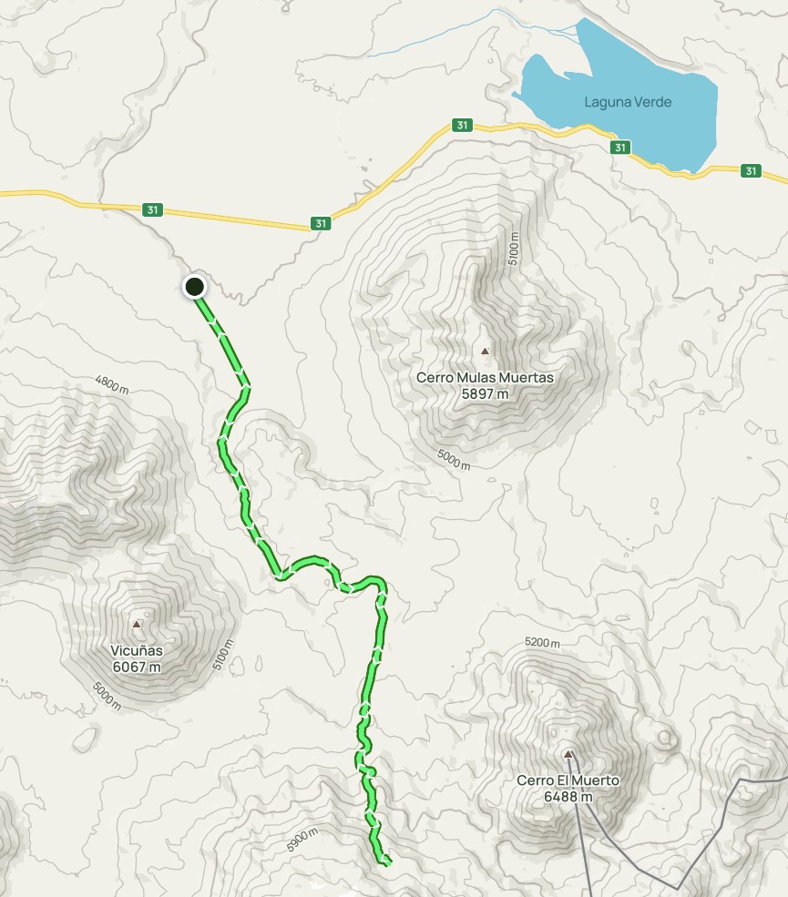
On Thursday morning 31th August at about 6:00 o’clock, Mario, Erik and I started driving from the Murray Hut to the Tejos Hut, where we checked out the track already two days prior. Shortly before the Atacama hut we had the beautiful full moon going down behind Volcano Tres Cruces while the sun lit its eastern flank nicely during sunrise. What a marvellous view. We drove about 400 m behind the Tejos Refugio and stopped at about 5,890 m. From here we started walking at about 7:30 o’clock. Mario said it was quite warm at that day, Typical in summer time they would start walking at around 3:00 o’clock in the morning, to be back before the strong winds from the Altiplanic Winter set in in the afternoon around 15:00 o’clock. And then after 3-4 h when they’re at about 6,400 m its the coldest part of the whole climb. As usual Mario instructed us to walk slowly. That shows his experience in the high mountains, that it doesn’t make any sense to try to run it up, like I had with Nikolas in Volcano Lanin. The Zig-zag’s up the mountain slope are already clearly visible from the Tejos Hut until about 6,400 metres.
Stunning Morning Scenery: Full Moon sets behind Volcano Tres Cruces just at sunriseThe Zig-Zag Track is clearly visible on the Mountain Side (there’re several tracks up the slope, and it’s not always clear which one would be best, but in the end just take the one which looks best – there’s no right or wrong)View Back to the Tejos Refugio and our parked car a few hundred metres behind at the end of the gravel road (that’s already after 2 h of walking uphill)
It took us about 4 h to get there. There wasn’t any new snow on the mountain. But you still had to cross this single old snow field, with pretty hard snow. We didn’t bring any crampons with us. Instead Mario decided to make some steps with his ice axe (Erik and I didn’t had any ice axe either). This took ages, even if it was maybe just 50 m, but he needed to carve each step. He also insisted to put me on the rope, but this didn’t felt good either, because the rope was quite loose while he was cutting the steps in the snow. Would I’ve slipped now, on this much slack line, there was no way he could stop me. And if he looses balance (for whatever reason), while he carves out the steps, I’m going with him (that was actually my most concern). If IFMGA guides put me on a short rope, they always want to have tension in the rope, that’s what you do while short roping. Mario has unquestionably lots of experiences in the mountains, but I’m not certain if he has any formal guiding certification. At least he never talked about any IFMGA training (or something similar), only that he was 7 years living in the Atacama hut.
Erik waiting on the steps of the old snow…you still don’t want to slip here
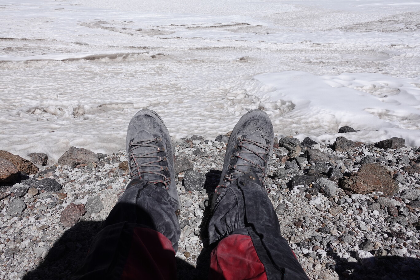
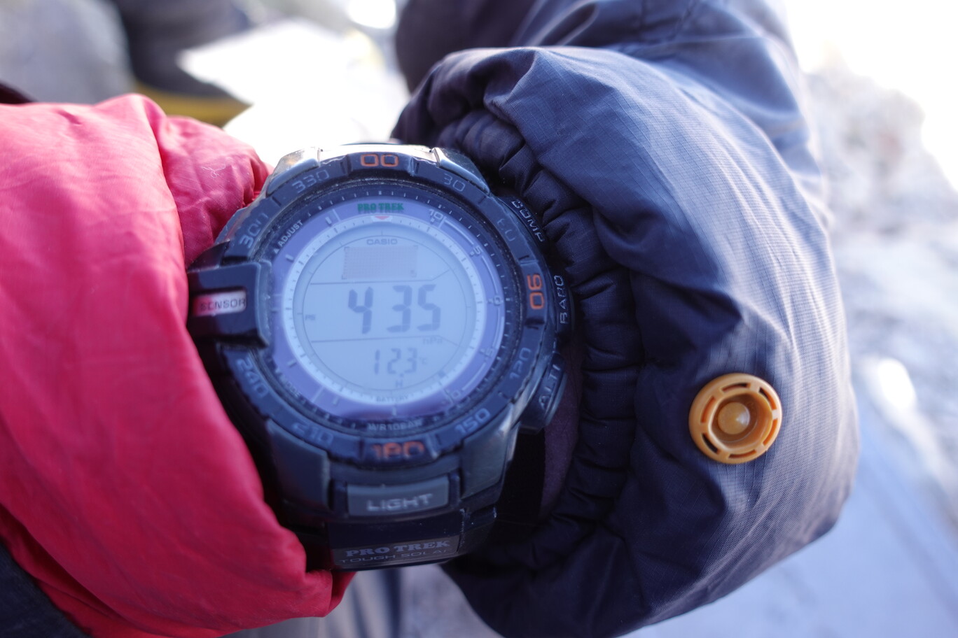
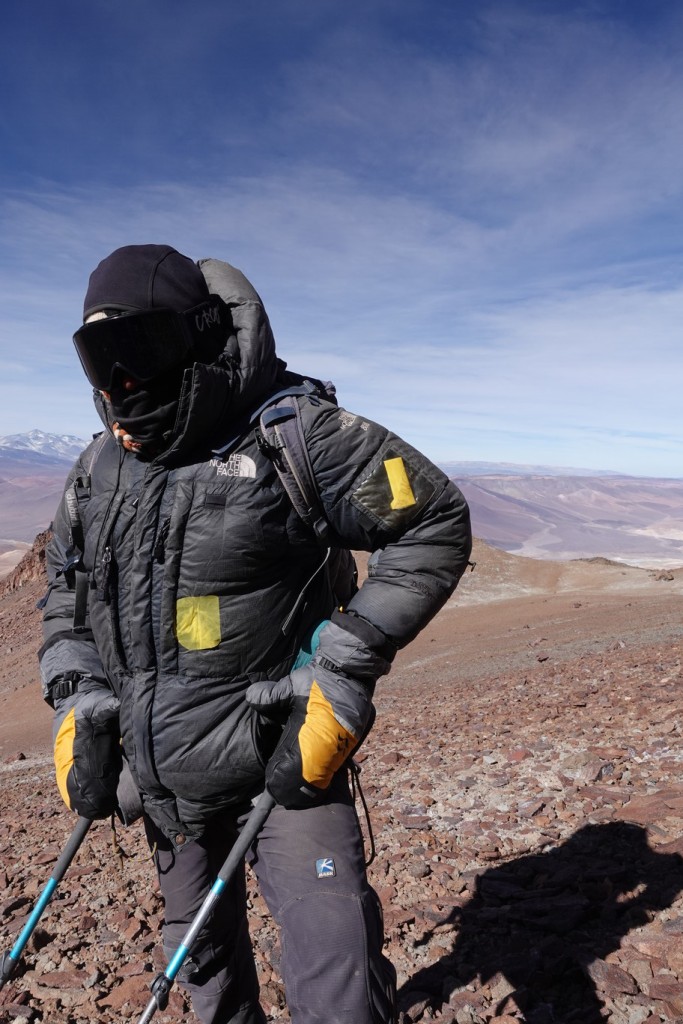
It took us another 2 h after crossing the snow field until we eventually reached the Crater Lake at about 13:50 o’clock. We made a short break at the highest lake on Earth, which was frozen when we’ve been there. Thus, no diving for us today 😜. I put my rain trousers on top, so that it’s an additional barrier against the wind. They were, as well as the Double Boots, already totally dusty. I think this was the only time I was wearing the double boots, which I specifically needed to rent (as instructed by the guides, and Mario brought them for me from Santiago, as I was already in Copiapo). I don’t know why, because the temperature and wind wasn’t that worse compared to the volcanos we did before. But maybe it’s just a safety thing, or in Summer as outlined earlier, it can get much colder in the morning.
Relaxing for a few minutes at the crater lake, my big double boots are already super dusty (the wind picks up the dust and shifts it constantly)Summit Area above the Crater Lake…the track spirals behind the lake into the (hidden) gully and then scrambling up onto the colWalking Along and Around the Crater Lake
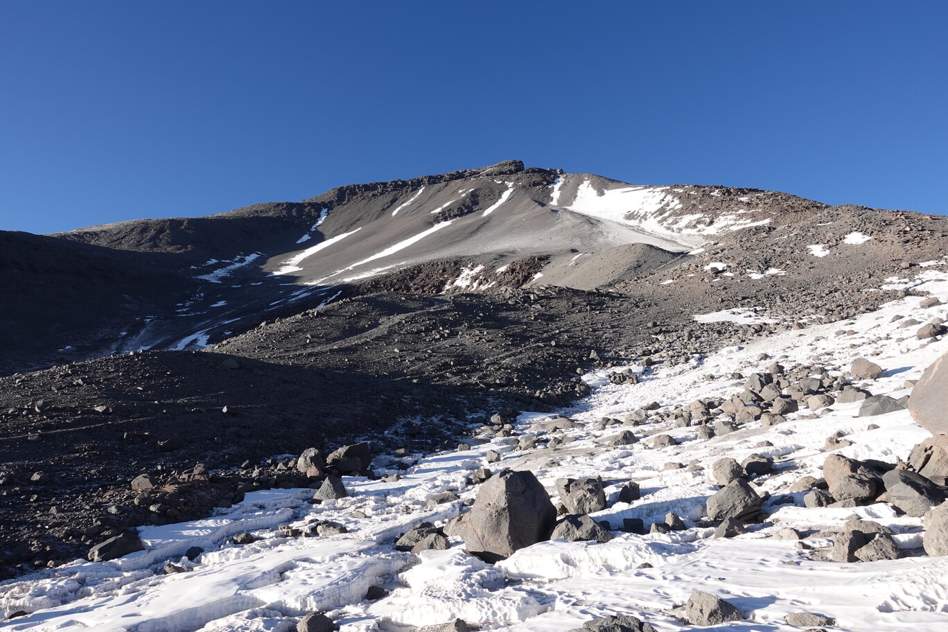
The wind picked up strongly after the Crater Lake. You make a half circle around the lake while gaining slowly some more elevation. Then we need to climb to a col between the two peaks. In this kind of gully the wind was super strong, it was magnified due to the stack effect I would assume, and some of the rocks were quite loose. So it was quite hard to reach the base of the scramble. There ware some fixed ropes for the last few metres of rock climbing, where you could hold on. In order to reach the col between the Argentinian and Chilean Summit, you need to basically bridge out for a few metres. And the you turn right, navigating the thin, and in parts exposed, ridge line. It’s a fun scramble, in particular in double boots, with strong winds, at almost 6,900 m elevation. I held onto a rock the size of a small fridge, and it was super loose. I almost pulled it down the mountain. But I though alright, I better don’t touch this one again. After a little bit more than 8 hours walking, we reached the Western Summit at 15:40 o’clock. It was just less than 3.5 km in length and 1,000 m elevation gain. Hence, this is just 125 m per hour on average, but the climbing rate exponentially slowed down on the way up. The last few hundred metres were absolutely the slowest. It’s less than 200 m from the Crater Lake, but it took us almost 2 h to get to the summit.
Erik climbing the ridge line in its double boots and full thermal clothing…it’s quite fun to do that kind of rock climbing with your thick gloves on (these are fixed ropes)
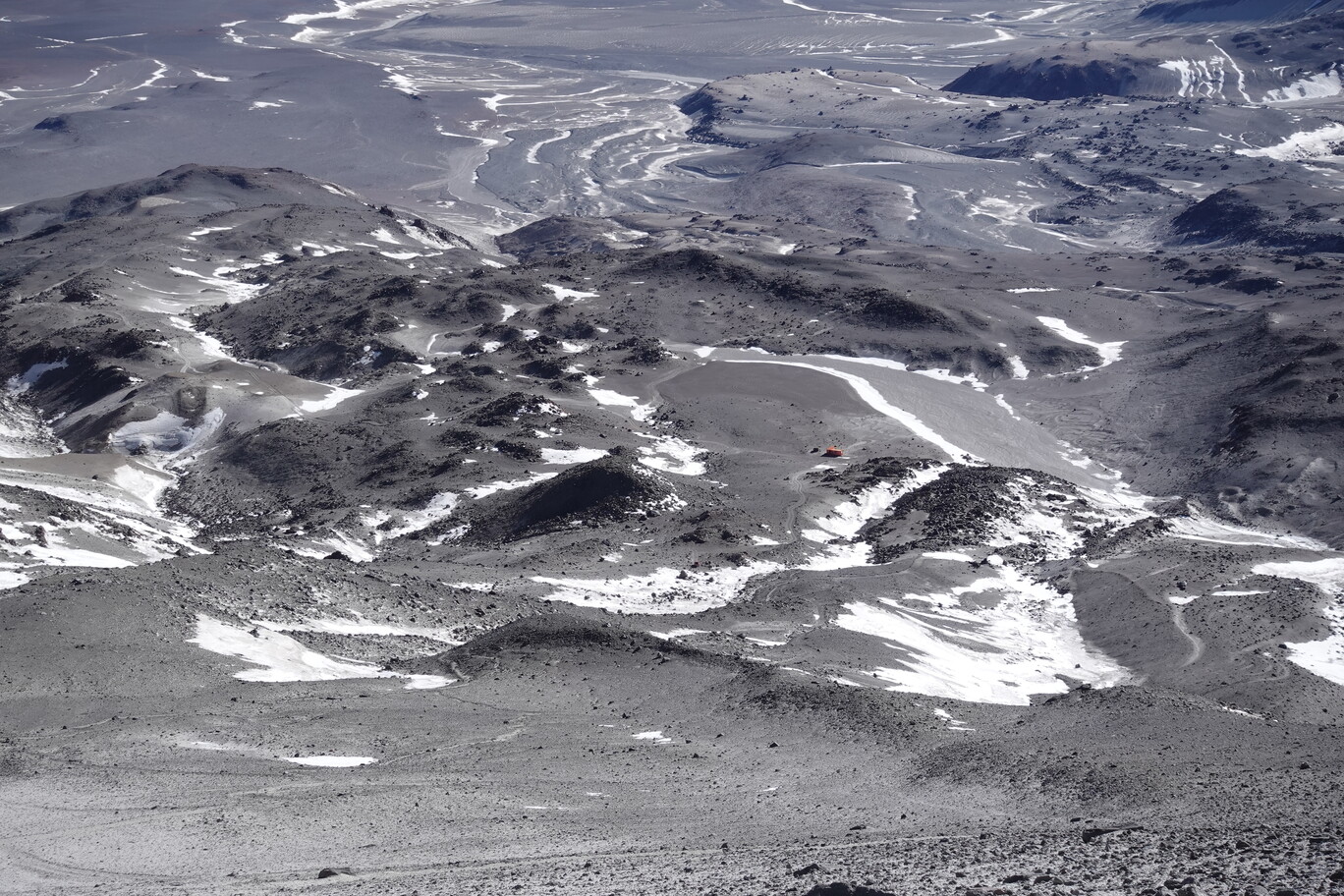
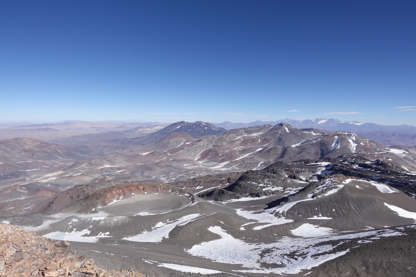
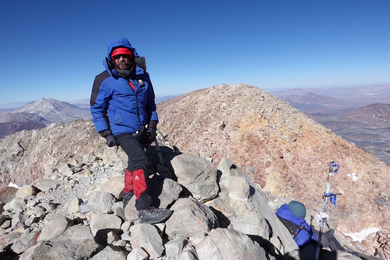
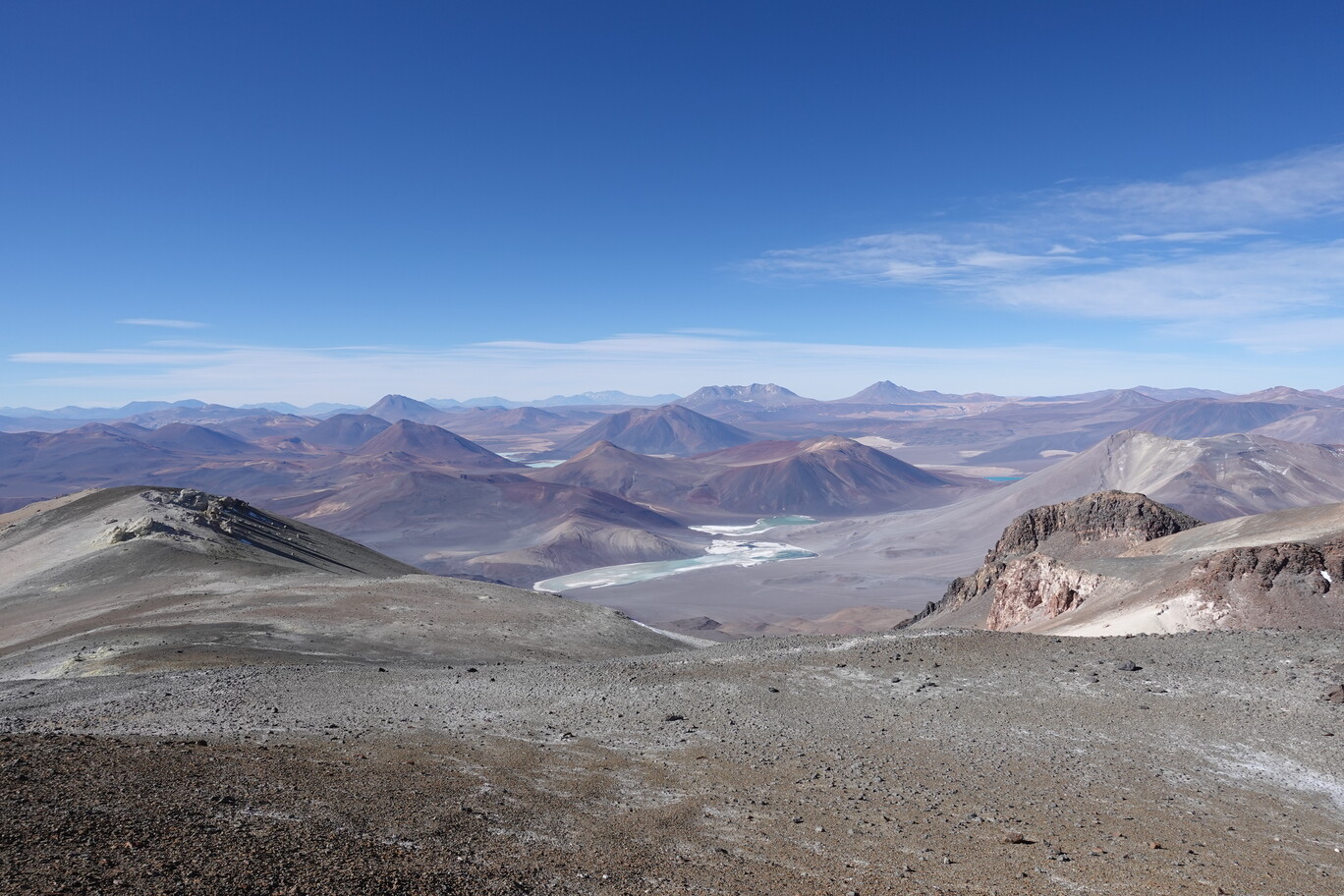
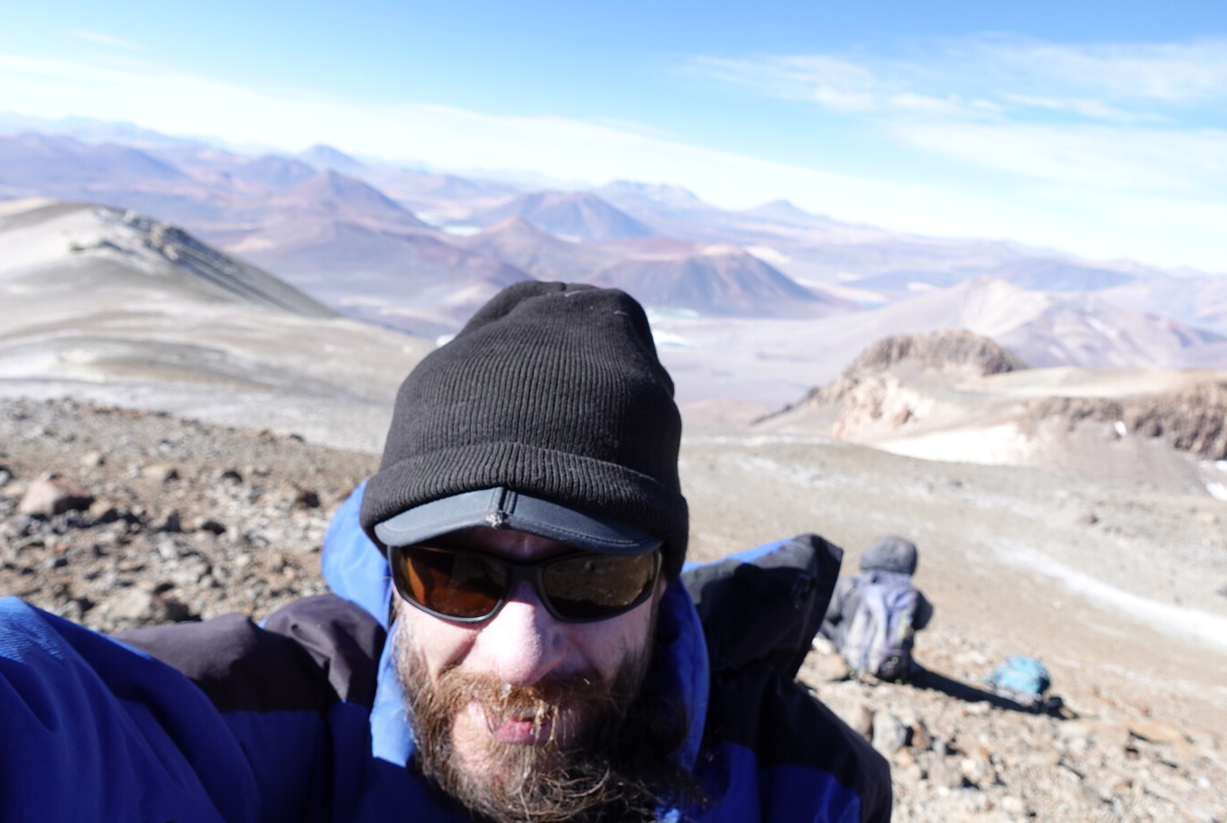
Summit of Ojos del Salado…the highest volcano on EarthView to the Argentinian (Southern) Side of Ojos del SaladoOne could even see the Murray Hut to the North, with the Crater Lake directly below usMe on the summit, with the Argentinian Peak directly behind usOnly about 40% of the air pressure is left here on the summit…the lowest I’ve ever been exposed to I guess.
Volcano Ojos del Salado has a double summit, one on the Argentinian side and one Chilean side, with the international border in the col which we just climbed, about 30 m below each summit. The distance of both summits is about by about 50 m. These two maximum heights of the main summit are also called: West Tower and East Tower. In November 2003, an Argentine expedition performed a topographical levelling from the Chilean summit. Taking the top of the highest stone from each tower, the West turns out to be higher between 54 to 5 cm (depending on measurement uncertainties). As I was on the Western Side with an official elevation of 6,891 m, I climbed the Highest Volcano on the planet, the Highest mountain of Chile and the Second highest mountain in America (after the Aconcagua), as well as the second highest mountain outside Asia, and the second highest mountain in the Southern Hemisphere. If the Argentinian Summit is lower (even just by a few centimetres), the low prominence of it, wouldn’t make it an independent summit, only a separate peak. And that peak would then “only” be the second high point of Argentina, and not Argentina’s second highest mountain (as the higher summit of Ojos del Salado is the Chilean Summit), that would be then Monte Pissis.
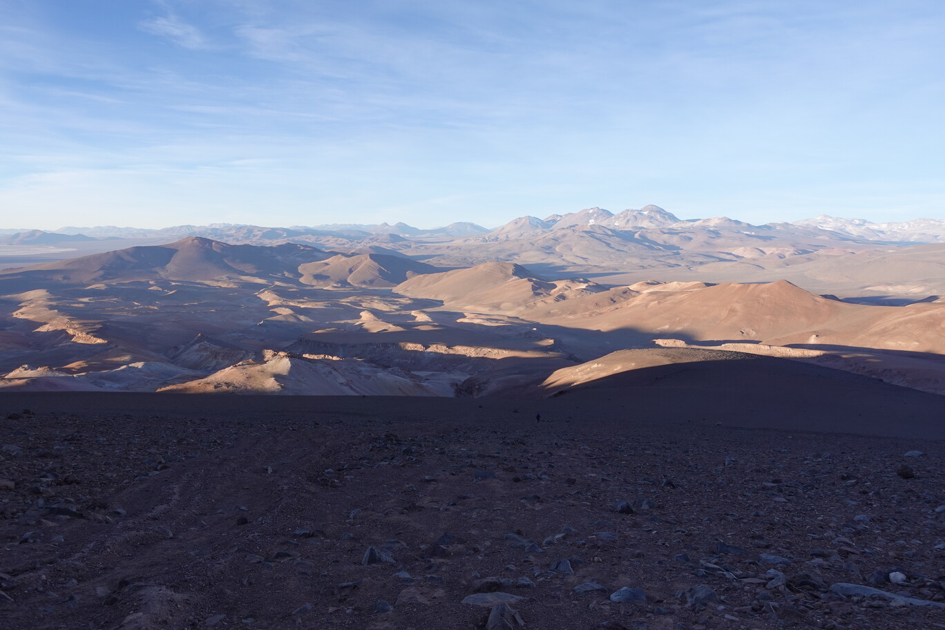
The wind was really strong on the summit. We made some summit selfies and recorded our ascent in the summit book, before we retreated after about 20 min on the summit. We took the same way back down. It took us only about 3 h to descent the 1,000 m of elevation, and we were back at the car shortly after sunset at around 19:00 o’clock, after about 12 h total time. Despite doing some acclimatisation in the 10 days before, I still didn’t feel very good acclimatised. I think a more gradual approach would be better (advancing each day by 400 m, and not running onto Volcano Copiapo already after 4 days from being almost at sea level before). But I’ve to say, that I enjoyed this summit much more than Volcano Copiapo. Nevertheless, a better acclimatisation would also greatly reduce the walking time. As the track is really easy, apart from the last few metres of scramble, there’s no technical obstacle. Machi said I would find Aconcagua boring, while we were climbing Cerro Capilla in winterly conditions. And sort of, she’s right, as Cerro Capilla was definitely more fun that Ojos del Salado. I agree that mountains like Mount Fitzroy are more interesting to climb, even if much smaller, than the big volcanoes, as you just walk up most of the time at the latter.
Stunning view of the surrounding peaks……during descent just before sunset.My trousers were super dusty (you can imagine how many dust ended up in my lungs), and as contrast they’re still black where the gaiters had beenWeather Forecast…there was only a short weather window with marginal wind on Thursday (and it was still blowing strongly on the summit that day)…and yes, the other days it had way more than 160 km/h (this isn’t exaggerating)…if you believe in another forecast with less wind prediction, good luck on you.GPX Track
On Tuesday, 29th August, Mario, Erik and I drove from the Murray Hut to the Refugio Cesar Tejos. For the first 19 km the track is more or less OK, the first 15 km are actually in good condition. Sometimes a bit soft and sandy, but in general no big obstacle. About 5 km before the Refugio Atacama we took the rocky road. Yes, it’s bumpy, but it was free of hard frozen snow. On the way back we tried this section of the road, but turned around quickly as there were several hard snow patches. The rocky road is for about 1 km not easy, but brought us safely to the Atacama refuge.
Murray Hut is the small dot below the cliffs of the outcropThis track section in the kind of valley can’t be missed……but is slightly soft (on the way down gravity helps).Ojos del Salado is now directly close in front of usThis was a really rocky and bumpy section…lots of material wear for the tyres
Mario spent 7 summer seasons here, when the Aventurismo company had a concession for the Ojos del Salado Volcano. Since Chileans do not require permits or entrance fees anymore to climb to the summit by this route, there’s also no longer any support or maintenance of the infrastructure. The last grading of the track to the Atacama hut took maybe place almost 10 years ago. Since then the track is constantly degrading. Mario was here stationed to give advice and perform rescues in case something happened on the summit. Due to the Altiplanic Winter you can have heavy rain/snow during the summer months. With enough snow on the mountain Mario did regular backcountry ski trips to the Crater Lake of Ojos del Salado at 6,720 m and skied down in 7 min (That means 1,500 m in 7 min, with an average speed of 60 km/h). Mario is maybe the person with the most ascents and experience of Ojos del Salado (and the only one, who’s crazy enough to go there in Winter). We had a quick look into the Atacama hut, before we hopped back in the car. There is a tiny creek behind the Atacama hut, which can be used in emergency as water supply, but is typically not sufficient. Also the lack of snow makes it necessary to bring all your required water with you…from Copiapo.
A new tiny hut was donated by a German Expedition (prefabricated in sections, all nice and good, expect they put the solar panel onto the southern roof…not ideal in the southern hemisphere 😜)Mario opens the door to his former living room (Atacama Refugio), and Erik waits to see it
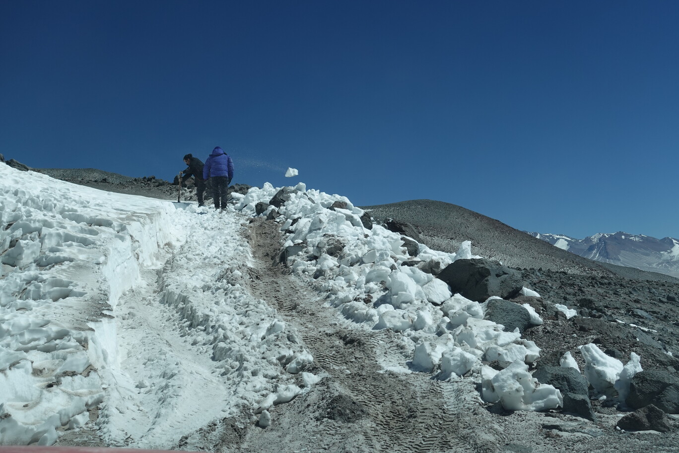
The last 4 km to the Cesar Tejos hut are really a rough track, and you still need to climb another 600 m. There are several deep potholes in particular in the first ramp after the Atacama hut, and it’s definitely steeper than anything before. There was a hard snow field on the track about 1 km after the Atacama hut. It was maybe less than 50 m long, but it took Mario and Erik 1 h to free it. Mario had several brute-force attempts to break through, but none were successful. So, in the end it was lots of handwork. Not only humans suffer from the lower air density, also cars have less than 50% of their nominal power, as less than 50% of the air gets into their pistons (compared to sea level), only less than 50% of fuel can be burnt within each stroke. So, I asked them, if they need help, but as they only had one crowbar, I stayed seated in the car as paying passenger, and let the guides work for their money. That was the only time, when they really had to work within two weeks, so don’t worry too much.
Gaining some elevation after the Atacama Hut……on a very bumpy track.Mario and Erik clearing the track from hard snow, so we can continue our drive to the Tejos Refugio (this photo was already after several failed attempts)
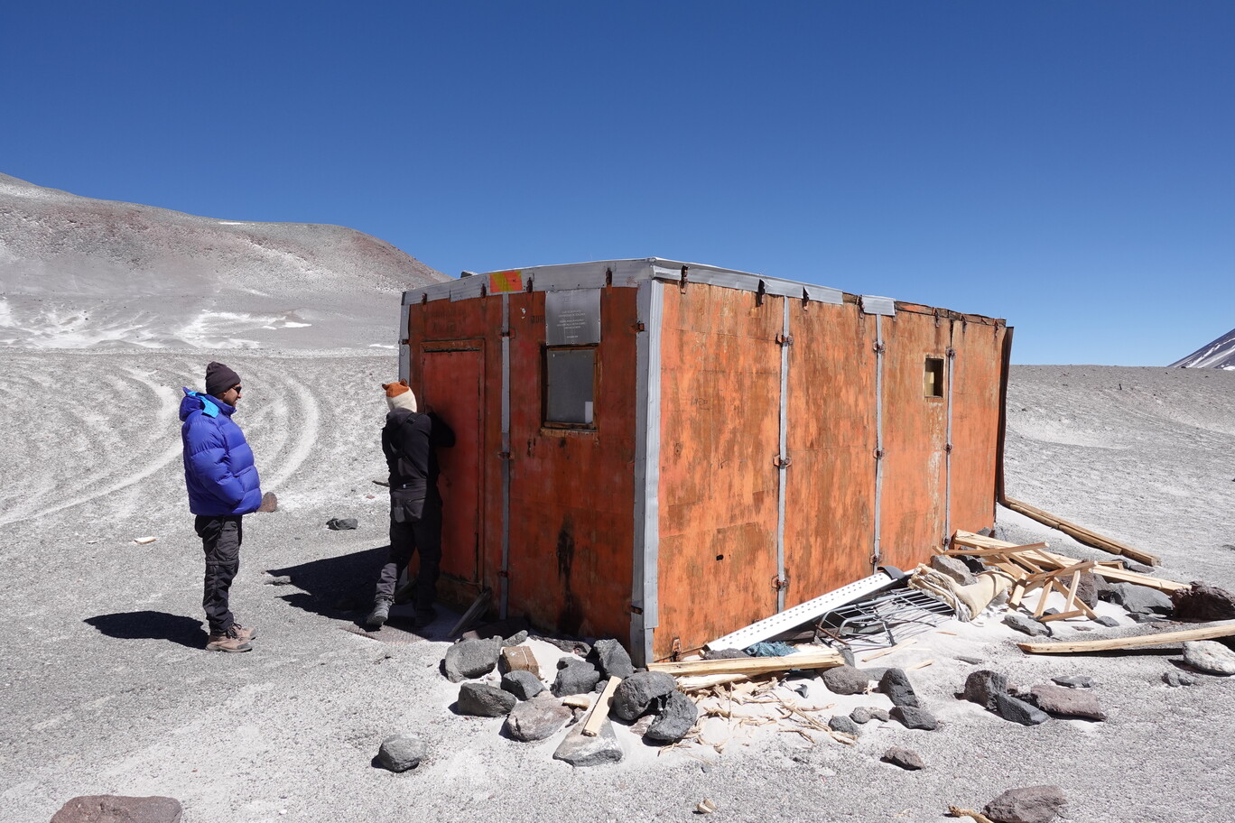
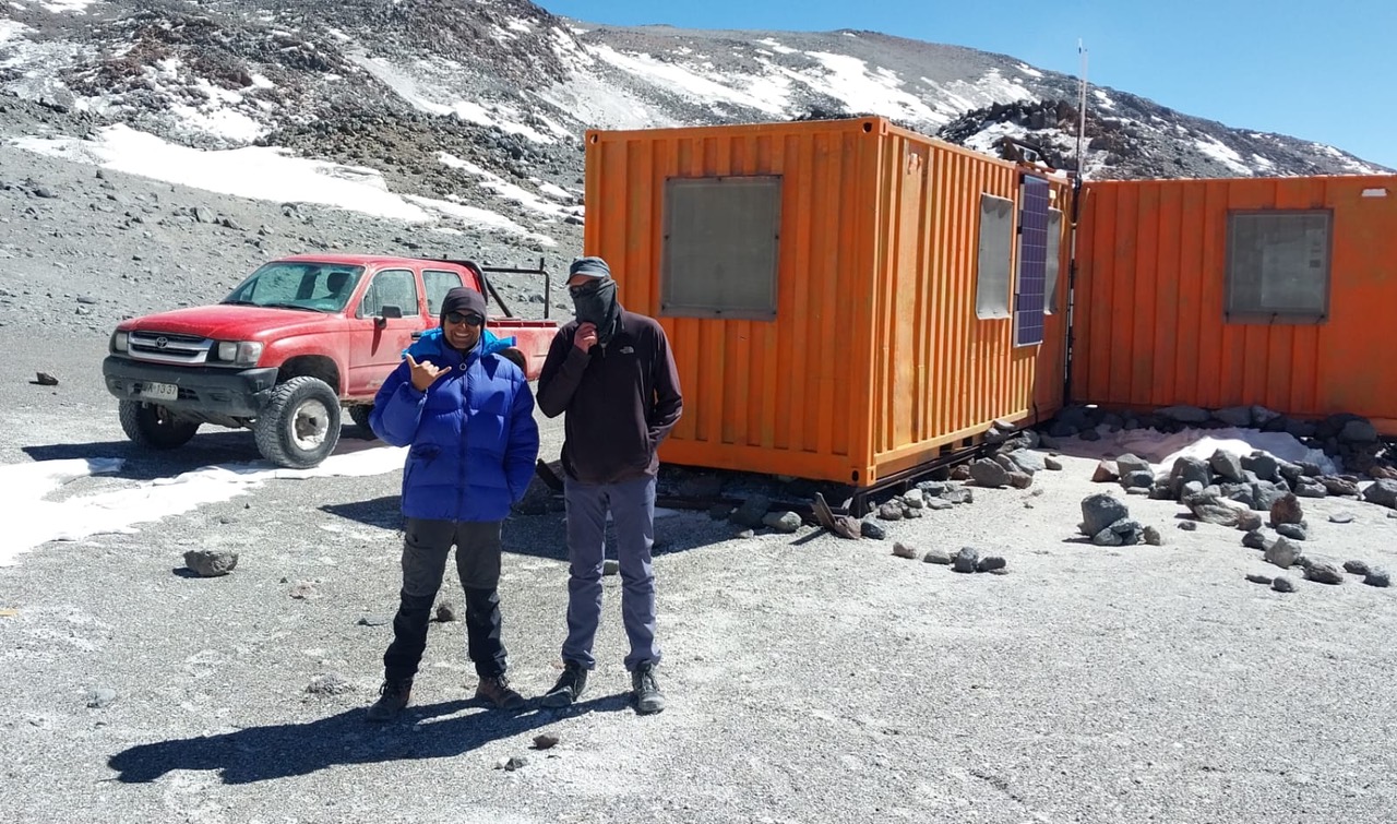
The Cesar Tejos is situated at 5,820 m and consists of two orange 20 ft containers. This shelter was installed (as was the Atacama camp) while the search for the Lama helicopter was being carried out, which on 14 April 1984 crashed into the Argentine face of the mountain and where pilot César Tejos and the director of the mining company Anglo American Louis Murray lost their lives. After passing the snow field the terrain eased of a bit, and we finally made it to the Tejos Refugio. The inside looks definitely like 1980’s, the door doesn’t close anymore properly, and most (all?) of the facilities inside don’t work anymore (I wouldn’t trust the toilet, nor the heater, nor the kerosene tank – even the modern emergency radio didn’t work, maybe the battery blew, as Mario did a functional test). But at least the 6 beds give you shelter in the unforgivable weather conditions here. There’s a weather station nearby, but due to the wind, it gets knocked over regularly. The track was constructed 40 years ago for the salvage operation, and since that finished, nothing seemed to be maintained anymore. It’s the highest mountain hut in the world at one of the highest public roads in the world. The road just continues for another 300 m until about 5,890 m, after that it’s all offroad. From here the current world elevation record set off in 2019, when a modified Unimog reached 6,695 m. We drove back to the Murray hut the same 23 km, as we came up. Driving in this desert is as adventurous as the Australian Outback.
Erik and I in front of the Refugio Cesar TejosWeather Station close to the Refugio Cesar TejosGPX Track
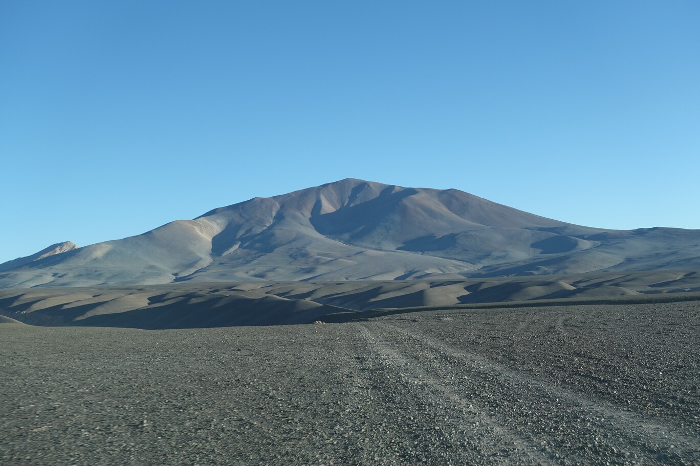
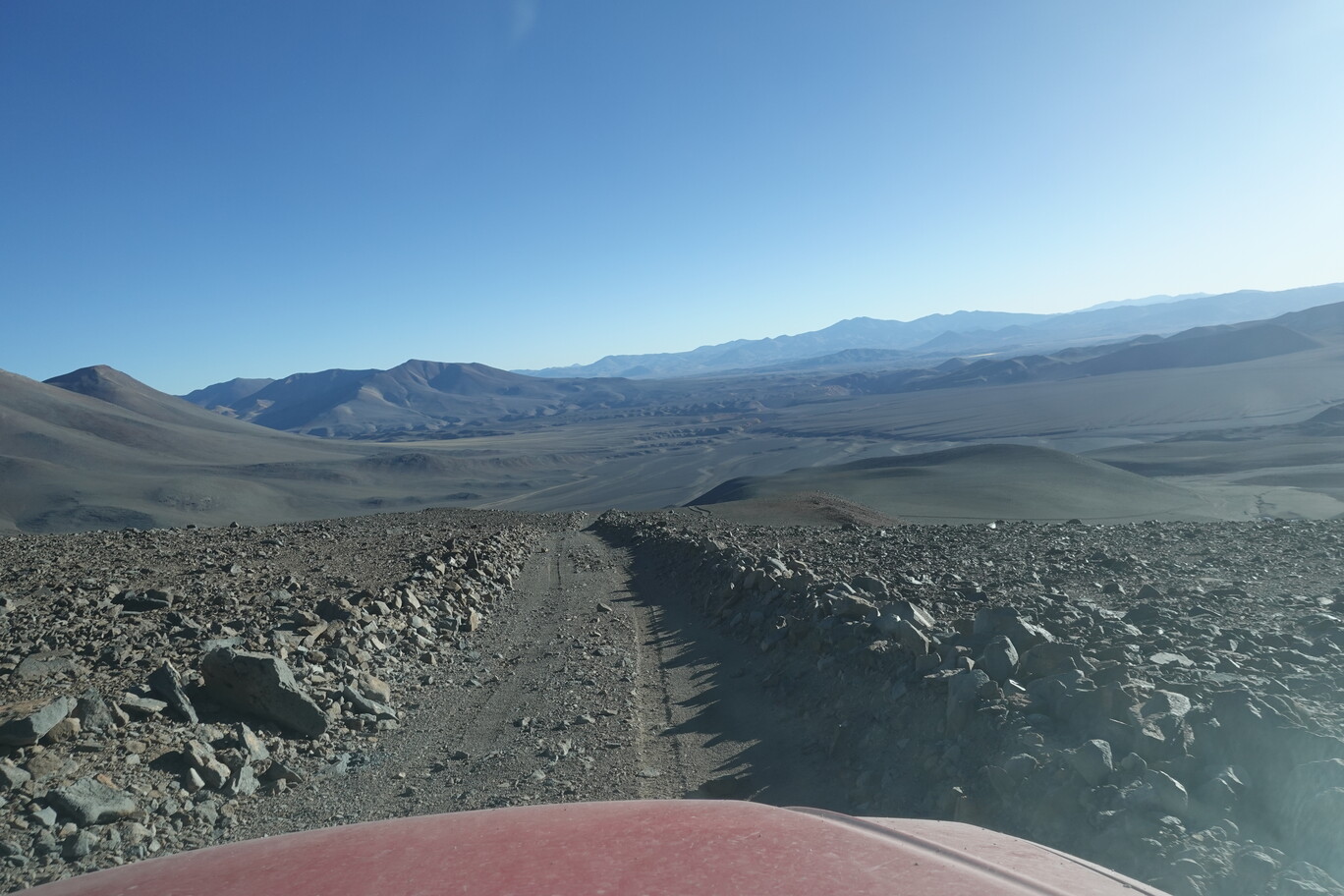
On Sunday 27th August Mario and I drove towards Piedra Parada. It’s about 20 km drive to the start of the hike. First we needed to get out of the valley of the Rio Negro on a steep ramp, and onto a wide open plateau. We crossed that plateau and already could see some old graded mining tracks leading up the mountain half. The graded road to the base of the mountain is actually quite good. But then you need to turn off into a steep valley, with quite soft soil. In the next 5 km the road deteriorated quite a lot. After the soft soil it got rocky. And I don’t mean a bit of gravel, but really sharp big rocks. Mario had good M&S tyres on his pickup, so we didn’t get a flat tyre at all. But it was definitely a material battle for the last 2 km of really rocky roads. The track ended abruptly, and Mario tried to get higher up, but the rocks in between were just too big. So, we started the hike at about 5,000 m.
First we need to get out of the Rio Negro Valley on this steep ramp Topping out onto the high plain (the cairn marks the way down – and up)……and driving to the base of the mountain.The zig-zag track on the side of the Piedra Parada is distinctively visible from the distanceHard to see in this photo, but this section of the track was really bumpy
The road was washed away in this section for about 300 m, but after crossing a dry creek bed (which seemed to get flooded once in a while), we easily followed the benched and graded track. Mario said it was built in the 1980’s for some mining explorations, but after that finished it was basically abandoned. The zig-zag track is still fine to walk, and maybe you could drive with a motorbike if you can make it to the start after the washout. But due to several small landslides onto the track, it’s maybe not suitable for cars anymore in the current conditions. We followed the zig-zag easily until it finished abruptly at about 5,600 m. Due to the more gentle way for most of the time, it was actually quite easy to walk in a decent speed.
After gaining a bit of elevation, a beautiful mountain scenery opens upThis zig-zag track below is already part of our hike, as we couldn’t reach the start with the carStunning views during the ascent
Mario had never been on top of the mountain and thought it’s only 5,700 m (or he mistook it with another mountain). But that’s actually not quite correct, as we realised too late, and 4 days after my ordeal at Volcano Copiapo, we made it to the summit of Piedra Parada at 5,920 m with 200 m more than anticipated first 😅. For the almost 1,000 m elevation gain, we only needed 4 h, which makes an average elevation gain of about 250 m per hour. The last 300 m were basically more or less short zig-zags and straight up this mountain side. Where possible we took more compact rocks, and avoided the parts which were too loose. The summit is only about 100 m lower than Volcano Copiapo, and it’s more like a psychological barrier, that it’s just below 6,000 m, rather than a physical one. Nevertheless, I could enjoy this mountain much more than Volcano Copiapo, even the latter is from an aesthetical point of view much better.
It got quite windy on the top, and we navigated our way between several larger boulders and rocks until we reached the summit ridge line. It was quite wide and we could make our way to the wooden pole and small cairn which marks the summit. We had a fantastic view to the North with Lagunas Bravas, Lagunas del Jilguero, Laguna del Bayo and Salar de Piedra Parada below us. But the strong wind only let us rest for a few minutes, before we started to hike down again. We made several short cuts on the way down, skipping several of the long zig-zags, and using some old vehicle tracks for it. It took us about 1:15 h to reach the car again, on more or less the same way.
On Saturday 26th August Mario, Elena and I moved to Termas de Juncalito. This is a tiny hut close to the spring of the Rio Juncalito and about 110 km away from the Maricunga hut. Just in case you wonder, we didn’t meet anybody else along the way. We first crossed the plains of the Salar de Maricunga, as before, but then turned left on the Route 31. We passed an open-air church, which is a great idea in this windy area, so at least no roof could be blown away…but not sure, when the next church service would be held (and for whom). The Chilean border and customs controls down the road were also deserted, because the international border to Argentina was closed. We turned onto the C-13 road directly afterwards, which was also sealed surprisingly, but after a few kilometres abruptly changed into a corrugated gravel road.
Open Air ChurchDrive for a short time on the sealed Route 31……and leaving the salt flat of the Salar de Maricunga behind us (with Volcano Copiapo to the right in the distance).We only met a few Guanacos along the way There was one copper mine up in the mountains along the road C-13
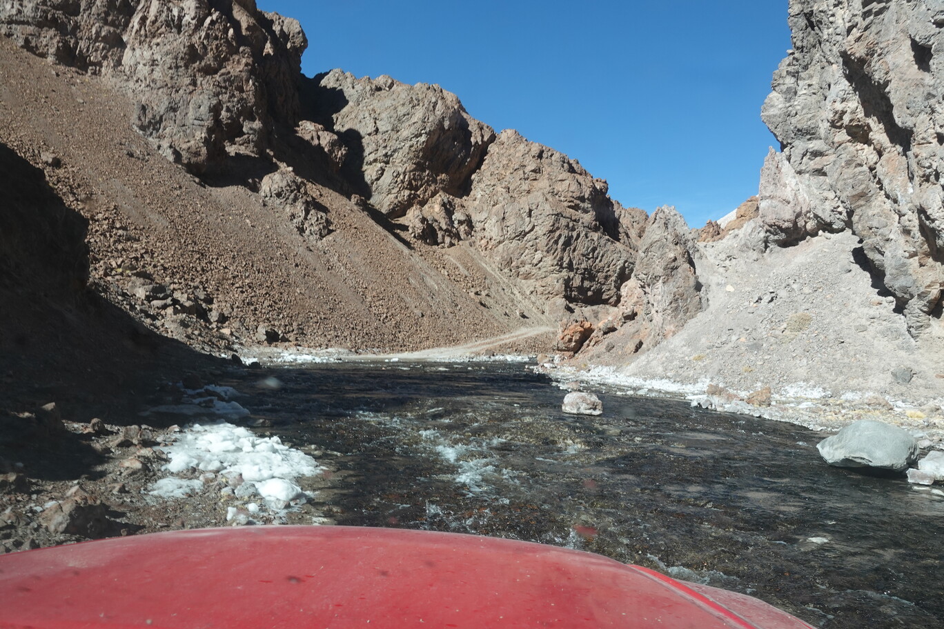
After about 40 km on it, we turned sharply to the right onto another gravel road. Until the Corrales de Juncalito the road is actually quite good. This is a small weir to dam the Rio Juncalito and supply water to Copiapo. The water pipes to Copiapo are no longer operational. Instead Copiapo is nowadays supplied by several wells. The support hut was open and clean. There was no rubbish, or broken windows. It could be easily used as a shelter in the middle of nowhere. The drive to the Cascada Juncalito, a waterfall of maybe 10 m, got already a bit sandy. The waterfall itself drops into a narrow gorge, and on the sides there is even some small ice formations. Mario told me that sometimes a few of his friends come here to do some ice climbing…Well, that’s maybe a bit marginal, but if you do it toprope it should be fine.
Corrugated Gravel Roads reminded me of Australian OutbackFollowed some interesting rock formations on the soft road Corrales de Juncalito is a former part of the water supply for CopiapoRoad got softer and the Valley narrowerRio Juncalito formed a narrow gorge…
…with a small waterfall at its beginning (with some ice formations on its sides).
After crossing the Rio Juncalito, the track got much rougher. The last 10 km to the Termas de Juncalito lead through a narrow valley. The landscape was gorgeous, but the track got worse with each metre. It was either sandy, rocky or wet, as in certain sections we just followed the shallow creek bed. It was as rough as I had experienced it in the Kimberley’s (but much shorter). The last 10 km were definitely the most challenging to drive. Apart from that, it was lots of driving just to change huts. Now we stayed at about 4,100 m above sea level, but due to the week at the Maricunga hut before, the 400 m more of additional elevation was unnoticed for me. The hut was quite broken. The old hut got literally blown halfway into the hot tub, and the roof of the newer was half blown away…yes, it’s windy here. Elena said the year before they repaired a bit the roof of the hut and it was still fine once they left, but due to the heavy winds, half of the roof was now flown away since then.
Marvellous view with the moon above the mountain and the Juncalito valley belowIf the road ends, just use the creek for drivingGetting to the real bottleneck of the valley…after this ramp……we need to drive through this narrow opening…in the creek bed.Beautiful Mountains surrounding the ValleyDamaged hut at the Termas de Juncalito…we pitched up one tent in the hut, as the door wouldn’t shut. The second night I got a visit from a fox who was looking for food in the hut.
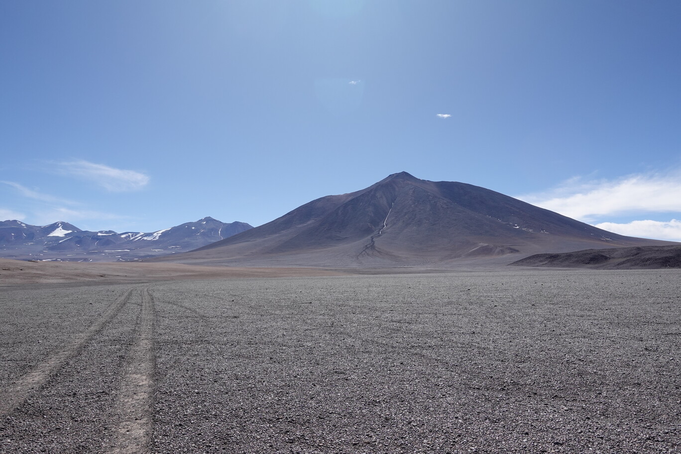
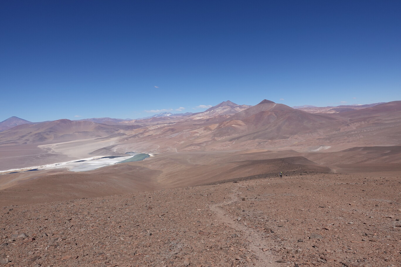
On Tuesday, 22nd August, Mario, Elena and I made an excursion to Laguna Verde. The international border at the San Francisco pass was closed during Winter. Hence there was literally no traffic on the road. First we took the gravel along Salar de Maricunga. This is an almost flat plain, squeezed in between the main Andean range and the Domeyko range. We past two houses. Those are housing water pumps for the Lithium mine, which is extracting Lithium from the Salar. Not sure if this water is sustainable or if it’s also just coming from an ancient aquifer. But typically you need about 30,000 litres of fresh water for 1 kg lithium…quite an amount in an arid area. We took the straight gravel road all the way to the sealed Route 31. It’s quite a strong detour, as we made a 160° turn, but it’s still the best way to get up there.
Crossing the plains of the Salar de Maricunga along the gravel road One of the water pump houses…the electricity lines were specifically built for thisSealed Route 31 leads to the border passVolcano Siete Hermanas with the Salar de Maricunga in front of itView back to the Maricunga plain
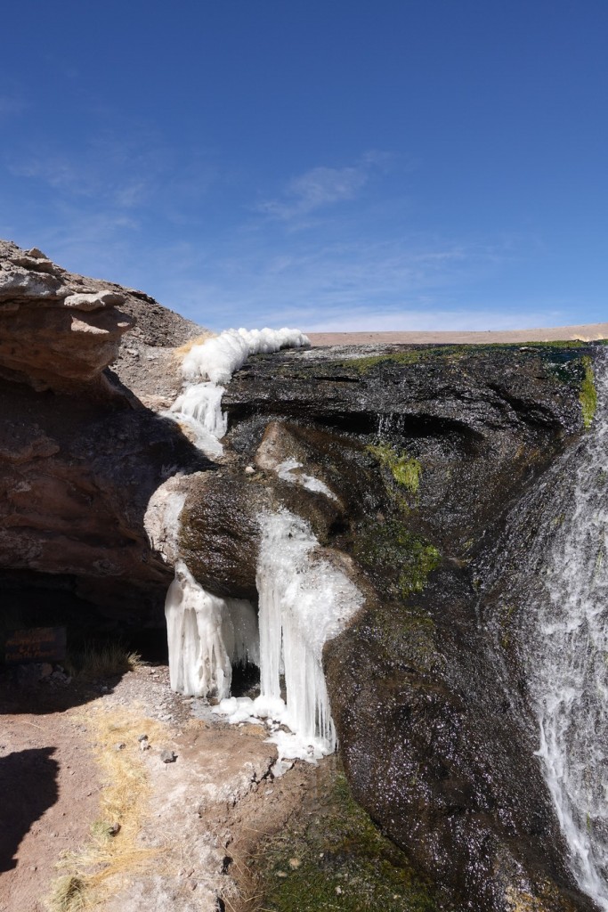
After we gained about 600 m elevation, we stopped at a small icy waterfall at Rio Lamas. Well it’s more like a creek, but a welcome contrast to the otherwise dry surrounding. It’s salty, so I wouldn’t drink it. I also didn’t taste it though. Nevertheless, this is like a tiny oasis, and a hidden gem in the approach of the Cerro Tres Cruces. After a short break (it was already quite windy), we continued along the sealed Route 31 to the Murray Hut. The hut lies already slightly above 4,500 m, but due to the acclimatisation of the last few days, that wasn’t an issue for me anymore. This is now a mountaineering refuge, but it is the former police station building, when the original gravel road passed here. Now it’s 3 km from the sealed road. The hut is open and we had a look inside. It was blowing a gale, so a bit of shelter from the wind was quite appreciated. The sky was clear and we could see the summit of Cerro Ojos del Salado, but due to the very strong wind heaps of sand was thrown up, which obscured the view to the lower mountain base.
“Rio” Lamas provides some salty water
Small Ice Formations at the tiny waterfall
(Nevado – well, there’s not much snow) Cerro Tres Cruces right of us Some other high volcanoes in the distance along Route 31Drop Down to the turn-off to the Murray Hut
Shortly before we descended a bit to the Laguna Verde Mario showed me his “hidden” campspot. Well, everybody can go there. It’s just 1 km away from the road, but hidden from the views and a bit sheltered from the wind close to the Laguna Verde. Afterwards we continued to the Refugio Laguna Verde. This is a former ranger station, but now in serious disrepair. It definitely lacks maintenance, and the only reason why it’s still there is because it has a small hot tub inside. Hence, you can have a warm sheltered bath after you finished your strenuous hikes. The air here is really dry and dusty. I was coughing the whole time. I’m not sure if this was still some remnants of my flu from early August, or if this is solely because of the very dry conditions which attack the lung.
Murray HutFoundations of an old destroyed building next to the hutSculpture (left) and Foundations of a Former Hut at the former gravel road alignment“Hidden” Campspot……next to the Laguna Verde (with a random stop sign in the middle of nowhere).
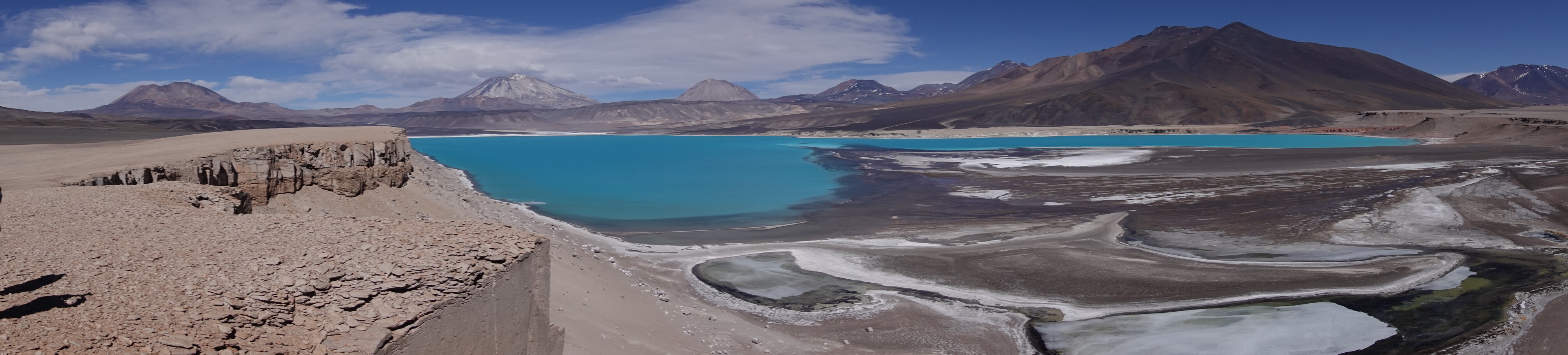
On Friday 1st September, Mario, Elena, Erik and I drove around the complete Laguna Verde. The lake as a very turquoise colour. It’s very salty, as it doesn’t has any outflow. Instead the water is constantly evaporating. On the drive in to the Refugio Laguna Verde there are still remains of a dead cow. Mario said that about 100 years ago they drove cattle from Argentina via the San Francisco pass to the mines in the Atacama region. This cow perished, maybe it drunk from the salty water, as it was thirsty, because there’s no other water available. The fur didn’t look that old, but maybe it’s well preserved due to the almost always freezing conditions here.
The Wind is so Strong that it knocks over Traffic Signs, like the one on the left (this is just one of several along Route 31)…now you know what’s meant by “strong wind” Laguna VerdeIt’s sort of shallow…but the strong winds form quite some wavesLooking Westwards over the Laguna…and the salty crust in front of itThe Cliffs at its Northern ShoreOjos del Salado in the back peaks between Cerro Mulas Muertas and Volcano El Muerto
We drove almost to the border, but then turned North around the Laguna and gained some cliffs at its Northern shore. The view was really spectacular, and there was nobody else being so crazy to drive there in the middle of Winter. We continued and stopped a few times more at the edge of the cliff to make some more photos. There was this gorgeous turquoise laguna below us and all the high volcanoes in the backdrop around us. After we found a way down between the cliffs we stopped at a pre-historic site. This is a very old shelter from early settlers, way before the Inca. The distances here in the desert are really vast. Our round trip today was about 220 km in total, and the next fuel station is 150 km away in Copiapo. So you need to plan appropriately, in this lonely area.
Erik tries to get the perfect view with the Volcano Nevado San Francisco in the back (another volcano above 6,000 m)Drive above the cliff lineMarvellous Scenery above Laguna Verde…the colours are still quite unrealRuins of a Pre-Historic site from the first settlers (way before the Inca arrived here)Made our way back through the col between those sharp hills…distances are just vast hereStunning View to Ojos del Salado in the AfternoonThe last few metres gravel close to the Murray Hut, just before hitting again the bitumen of the Route 31Stunning Sunset with Lenticularis Clouds above Cerro Tres Cruces from Refugio MaricungaGPX Track
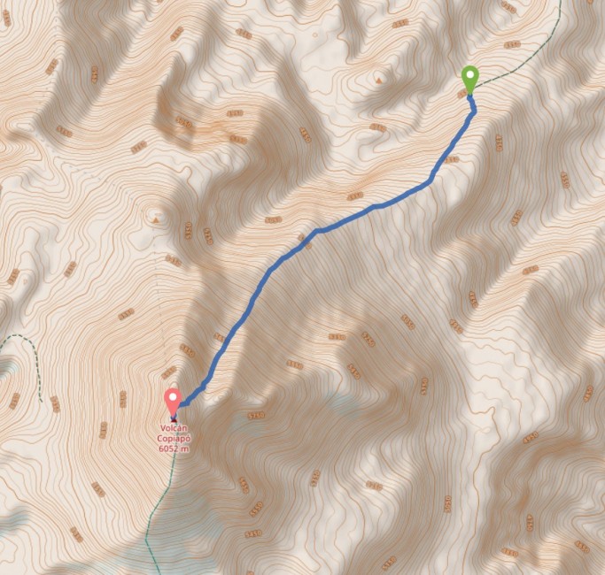
On Wednesday morning, 23rd August, Mario, Erik and I drove about 44 km from Refugio Maricunga to the base of the mountain at about 4,660 m where we arrived after about 1 h. For safety measures we took our sleeping bags with us, as there’s nothing around. The nearest help would be Elena in the hut, but she’s without any car. Thus, access to the mountains is the biggest obstacle here. It was a perfect nice day again. No clouds, and for most of the walk, we would be sheltered from the strong winds on the eastern side of the mountain ridge.
Driving almost 50 km to the base of Volcano CopiapoFollowing a tiny creek after the turn-off from the main roadGetting to the base of the mountain at almost 4,700 mGetting a glimpse to Salar de Maricunga from the start of the hike
We started walking at about 8:45 o’clock. We reached a wide plateau after a short steep ascend. For the next 2 h we followed this plateau and gently made about 500 m elevation gain in the 2.5 km. Along the way the view got continuously better, the higher we got. We always had the Salar de Maricunga to the North and the dominating Cerro Tres Cruces to the North-East.
Easily Following a gentle inclining wide plateau……to the wide gully on the North-East slope of the Volcano.
We continued along a wide gully, and it got a bit steeper. The elevation in combination with the thin air was the main hurdle that day. Technically, it was very easy to walk, but the higher we got we slowed down considerably. Mario always said go slow, in particular in the high mountains that’s the best advice, because it doesn’t make any sense to try to go quicker. You just start hyperventilating much more quicker, and then you need to stop for a few minutes until your heart beat slowed down (a bit). You try to grasp for air, but your lungs really feel empty all the time.
View to the North with Cerro Tres Cruces (right) and Salar de Maricunga (left), and the small spot of our red car at the base of the wide plateauErik (left) and Mario (centre) on the way to the wide col
We had lunch break at a sheltered spot. It’s going all in slow motion, and due to the low air pressure, you feel you’re constantly in a movie, and not in reality anymore. It’s quite surreal what this low air pressure is doing with your brain and the human body. We could see the col all the way up, but time just flew and it took us almost 6 h to get there. Once we passed the col, we were exposed to the strong winds. My rented jacket, had only a bad hood, and I had trouble to secure it. My nose was exposed, and even we were only a few minutes traversing to the summit in those conditions, I think I got slightly frostbites. In this traverse I only functioned, I did one step after the other, but it was more like mechanically. Due to the problem with the hood, my visibility was also reduced, but I didn’t want to take the time, and get out of my big gloves and try to fix it (because with the big gloves, you hardly can grab anything).
Mario fully clothed in the stormy wind on the Main Nothern Ridge Line
We passed two Inca platforms which were supposedly used for some sacrificial rituals. Shortly afterwards after about 7 h up we reached the summit of Volcano Copiapo at about 16:00 o’clock and after 5 km walk and 1,400 m elevation gain. It was my first summit above 6,000 m, but it’s the summit I enjoyed the least. I was so out of air. It was just surreal. I was happy that Mario and Erik were with me. Alone I don’t know what would’ve happened. Again, it was not a technical issue, the low oxygen just drains all the energy out of you. We had a great 360° view, we could see Cerro Tres Cruces and Cerro Ojos del Salado to the North-East, and the main Andean mountain range to the South. But I was more busy to breath, and get myself sorted in the stormy conditions.
Inca sacrificial sites shortly before the summit on the Main Northern Ridge Line, with the eastern pre-peak to the right (below us)
Summit of Volcano Copiapo
It was a marvellous view from the summit (but I enjoyed it the least)
My first summit above 6,000 m (my watch was surprisingly quite precise with the elevation)
We went the same way back as we came (instead of zig-zags we just walked down straight). After we left the summit ridge line, and got down in the sheltered wide ascent gully, I just sat there for about 5 min. My heart beat was way above 160 and I was hyperventilating the whole time. I know I needed keep on moving, as it would get better further down, once the air gets more dense again. But I needed to rest first, and collect some energy before moving on. At about 17:30 o’clock Mario headed in front of us to the car, and I walked with Erik for a while until sunset. I arrived back at the car after sunset after about 10 h at about 18:45 o’clock. Mario put on the headlights of the car for a better orientation for us. Nevertheless, I didn’t understand why we didn’t start walking 1 or 2h earlier in the morning, so we might have more spare time in the afternoon. Also doing a 6,000 m peak, just 2 days after I got to (almost) 5,000 m, and 4 days after I left Copiapo from 350 m, seemed to me a bit too fast. Typical acclimatisation time for 6,000 m is 14 days and not 4 days. I was totally exhausted afterwards for several days. I think a 5,000 m peak would’ve been more appropriate. In the morning Mario drove gently over the gravel and dirt tracks. In the evening, Super-Mario drives like a maniac on the way home, even Erik complained about it later at dinner. I mean sure, nothing happened (this time), but you don’t want to crash into something in the middle of nowhere (literally), just because you thought you might safe 5 min. I think this is quite reckless, even if you might know the road, if the next help is hours (or almost hundred of kilometres) away. Those mountains, in particular in Winter, are very remote and lonely places.
Last view to the North-East in a nice late afternoon light shortly before sunset
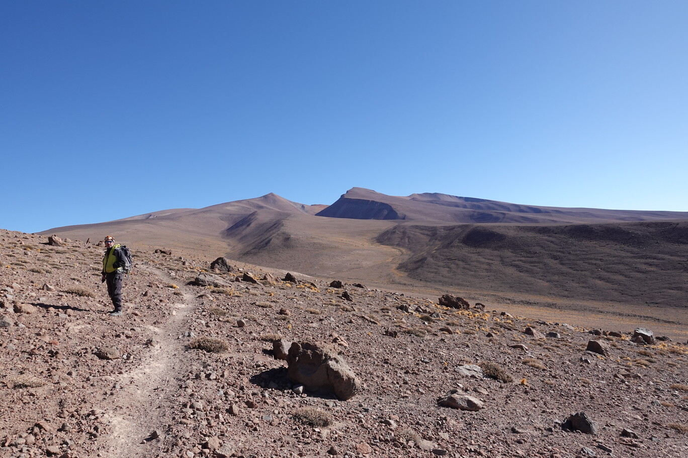
Monday morning, 21st August, after breakfast Mario and I prepared to climb Volcano Siete Hermanas. The track starts directly behind the refugio. The weather was clear, no clouds in the sky, and with the sun and almost no wind it was quite pleasant (in the hut). Mario already showed me the day before from the Maricunga Pass the summit, and our first destination. The track follows naturally the wide mountain spine. It is gentle all the way up and easy to walk. For the first maybe 1 km you follow a tourist track with information panels, which explain the history, flora and fauna of that place. It looks like those were created by the rangers of the Tres Cruces National Park. At the almost end of this tourist track you veer off to the right, and follow a well used path. There’s the occasional cairn along the way, and sometimes the track is a bit faded away, but in general you just follow the gentle mountain spine on the least resistant way.
Mario on the track to Volcano Siete Hermanas (the summit is the one slightly on the left)Laguna Santa Rosa with the Refugio Maricunga (left) and the ranger station a few hundred metres to the right along the dirt road
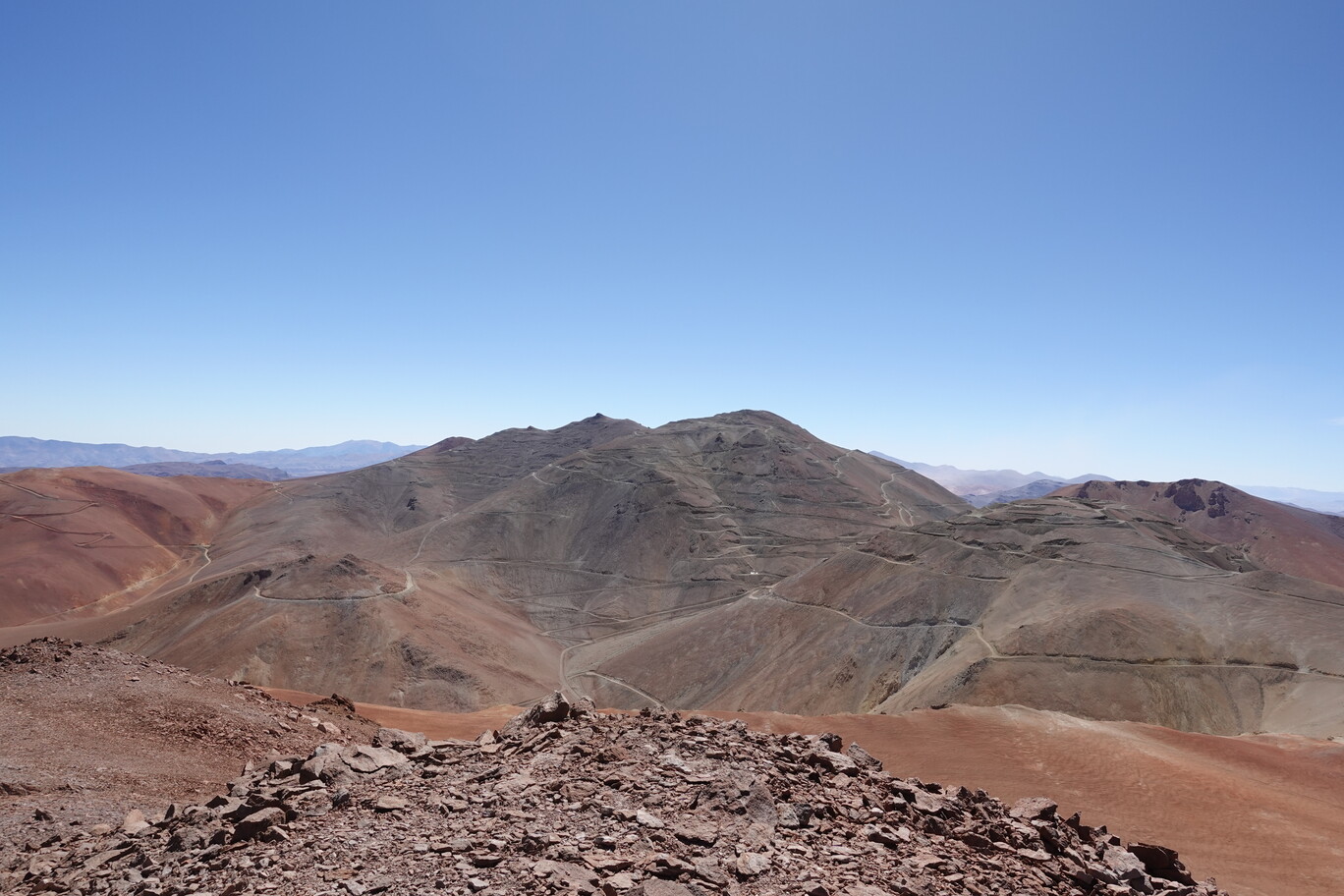
Nevertheless, you need to take into account that I slept at 3,770 m and started from there, and that the summit is at 4,870 m. So, it’s still a proper 1,100 m elevation gain, even though this mountain is quite low compared to the other surrounding mountains. After about 3 km the track slowly veered to the North in order to follow the North-South spine. The higher we got, the stronger the wind picked up. It was much more windy than I anticipated. I know it’s always more windy on the summit, but in this case the hut was exceptionally sheltered from the westerly winds, and left you in the wrong impression that the weather is actually quite calm. I didn’t take my thick gloves with me (big mistake). So my fingers got really cold. We needed to stop and Mario gave a spare pair of his gloves. Erik, our young host from the hut, followed us and caught also up with us. Despite that he’s working in the hut (on and off) since almost 2 years, he never made it to the summit of Volcano Siete Hermanas, only once to the veer off of the North-South mountain spine.
Following the gentle mountain spine uphill creates new views to the surrounding mountainsWe took the road across Maricunga Pass the day before
After about 3 h we arrived the summit. The wind was very strong, so we took shelter behind some cairns for a short lunch break. I only had a small snack, as with the high elevation I’m not getting very hungry. The wind was even so strong, that I didn’t had the patience to make a summit selfie, or a photo of the summit itself. There’s some telecommunication antenna on the summit. Hence, you can’t miss it. There’s an abandoned mine site on the next mountain. Mario told me that the company was badly managed and couldn’t pay the environmental bills, and eventually went bankrupt. Hence, all what is left now are their access roads all around the mountain. The summit is called Siete Hermanas, because the volcano has 7 distinctive peaks, hence, 7 sisters. This is the highest peak of it you can access, the others are within the mine site. It was the second highest summit I ever climbed in my life, after Haba Snow Mountain. After a few minutes on top, we made our way back to the hut. The same way as we got up. It took me about 2.5 h down, and in the mid of the afternoon we arrived back at the hut after about 15 km walking.